|
Home - Current Road Programme - News Archive
NEWS ARCHIVE Update 12/12/2020: There is a public consultation on the M20 initial route options happening until Jan 15th 2021 on www.corklimerick.ie, the M20 scheme website. On the homepage, click "Public Consultation". After you have entered the room, high-detail maps of the road and rail options can be found by clicking the large map icon in the centre. When the map opens, you can use the layer icon on the top left to switch on and off the rail and road options. Queries can be emailed to info@corklimerick.ie but you can also book a video session with them. Recently I attended a zoom meeting on the M20 project hosted by Limerick TD Kieran O'Donnell, featuring spokespeople from the project team, Irish Rail, Bus Eireann and others. At the meeting it was confirmed that an option that connected the M20 directly to the Limerick ring road was ruled out at an early stage as it would have routed the road too far from Croom and Adare. Additionally the chambers of commerce of N20 towns like Charleville were anxious to have the new road pass as close as possible to their settlements so that they can maximise their access and connectivity. Regarding the rail improvements, according to Irish Rail, choosing rail option RS1 (Improve existing rail line) would be by far the easiest and cheapest option. A land reservation to double Limerick-Limerick Junction already exists as the route used to be double track and a program to close level crossings along Limerick Junction to Cork is already underway. Currently the rail journey time ranges from 1h30 - 1h40. Such an intervention would reduce this to 1h15 - 1h20. Options where a new piece of rail line is built would take a lot longer to build and greatly increase cost, though they would reduce the journey time even further. The takeaway from the meeting was that rail options that involve building a new alignment are effectively already ruled out and the consultation may just be a box-ticking exercise. There will be a further public consultation in summer 2021 which will unveil the preferred route. Update 04/12/2020: A scheme website has been set up for the N4 Carrick-on-Shannon to Dromod dualling scheme. The study area is visible on the Interactive map (don't bother with the huge PDFs). The new route could go either north or south of Carrick. This amazing drone video of the Macroom Bypass section of the N22 Ballyvourney-Macroom project has been created by speeding up footage taken by flying over the site. It can be seen that significant progress on earthworks and more modest progress on the bridge structures has been made. The project's challenging terrain is very visible. At the end of the video, at the west end of Macroom, no progress at all has been made - the fenced but untouched site can be seen. Progress has been made at the far west end of the scheme, but that isn't shown in the video. The Connaught Telegraph has reported that the N5 Ballaghaderreen-Scramogue scheme has slipped and will not start until Q2 of next year. Previously it was Q1. A Mayo Deputy comments on the project as follows: "TII have confirmed to me that tenders for the main construction contract of the N5 Ballaghaderreen to Scramogue Scheme are expected to be received in Roscommon County Council by the end of this year with the review of the tender documents taking place during Q1, 2021. This is not a trunk route, but it's a major and very expensive scheme - the new Killaloe bridge in County Clare. Clare County Council is making significant progress delivering the Shannon River Crossing project, which will be one of the biggest infrastructural project in South-East Clare.Here is a map of the route of the scheme. Update 22/11/2020: The planned M28 motorway between Cork and Ringaskiddy has had repeated legal actions taken against by a local residents' group, the M28 Steering Group. Previously, in December 2019, they challenged the planning permission it had been given by An Bord Pleanala in June 2018. Now, they have been refused permission to bring the High Courts decision to the Court of Appeal. They have stated their intention to petition the Supreme Court to hear their case, but the legal bar for such a hearing is very high. Observers are guessing the project is probably clear to proceed now. Route options for the M20 Limerick-Cork motorway have been published. These are mostly east of the existing N20. Options for the potential rail improvements are on page 8 and include an upgrade of the existing rail lines, and the building of short segments of new line to make a shorter route. Planning has begun for the Cork North Ring Road. This will join the N40 at Ballincollig to the N20 and future M20 at Blarney, and finally to the M8 north of Glanmire. It is possible the road may be tolled. Note that a route number has not yet been assigned to this road. It has been confirmed that work on the N5 Ballaghdereen-Scramogue single carriageway road will start early next year. The project was tendered in July of this year and preparation is continuing apace, according to the Roscommon Herald: ...The stretch of N5 linking the Ballaghdereen bypass to Scramogue was proceeding, with works ongoing, including works on fencing and archaeological testing. He said construction tender documents had been issued on July 22, with the process ongoing. Update 12/11/2020: The contract for the 35 km N5 Strokestown-Frenchpark scheme will be awarded soon, according to Shannonside. This scheme has moved surprisingly fast through the planning system. The TEN-T projects in Donegal are making progress and are due to move to CPO (Compulsory purchase) in March/April 2021. The name refers to the N56, N13, and N14 projects in the county: N52 Tullamore-Kilbeggan route options have been published and can be found on the official scheme site under the section "Second Public Consultation - Route Corridor Options". It can be seen that all options are east of the existing road and tie into the N52 roundabout north of Tullamore. The last of the concrete beams for the N4 Collooney-Castlebaldwin schemes have been put in place, as this image from Boards poster M17 shows. The route options for N3 Virginia bypass have now been reduced to 5. Only 1 passes south and west of the town with the rest on the other side. There is a virtual meeting room displaying the options. This includes an introductory video. Finally, here some videos of the works taking place on the N4 and the N22. Update 01/11/2020: On Twitter, some photos [1], [2] of the Macroom bypass have been posted. The western part of the scheme (N22 Macroom-Ballyvourney) will take a few years to do, but the parts near Macroom can be seen to be making good progress. The website for the N24 Cahir-Limerick Junction scheme is live. Right now it doesn't have much content, just a map with an indication of the scheme location which is along the existing N24. It states that route options will be available by Q2 next year. A photographer has put up some photos of the alignment of the future N52 Ardee Bypass. With luck this new single carriageway scheme should start construction by the end of 2021. The newsletter for the N4 Collooney-Castlebaldwin is out. It shows that practically all earthworks are done with significant progress on structures, many of which are over 90% complete. The scheme is still on track to be completed by August 2021. Route options are out for the N25 Carrigtwohill to Midleton scheme. The scheme only covers the part between the two towns and does not improve the roundabout on the N25 south of Midleton, for example. One of the four options comprises improvements to the existing road and the other three are new routes, with the existing route returned to local access only. When the road was dualled in the 1980s it was just a doubling of the existing carriageway with no attempt made to improve junctions and side roads. Update 16/10/2020: The Dunkettle Interchange upgrade project, following its retendering, has been awarded to Sisk. The cost is €215 million, but it has been stated that €40M has been saved as a result of stopping work and retendering due to the huge cost escalations the project was seeing. The completion date of Q1 2024 indicates it will start construction early next year at the latest, assuming a 3-year construct time. That said, advance works have been underway all year so really we could see a full scale-up of activity much sooner. The TII have put out a major project tracker, the first they've done in years. Not a lot of surprises in it but a few things of note : * When all N21 schemes are completed, there would only be an 11 km gap in the dual carriageway between Limerick and Abbeyfeale. The road beyond there to Tralee was upgraded in 2006 and does not require improvement. The new starts we should see in the next 12 months, apart from Dunkettle, are all single-carriageway roads. In the first half of 2021, the following schemes should begin work: In the second half of the year there should be: Update 06/10/2020: The huge N17 Knock-Collooney scheme now has an official website. The Mapping page shows the route options. The new dual carriageway may be as much as 55 kilometres long so this will be transformative for the region. Some of the routes go west of Knock airport and west of Tobercurry, some east. At Collooney some options start north and some south of the town. Update 29/09/2020: We may be mere days away from receiving cabinet approval for the start of full works on the Dunkettle Interchange. The Irish Examiner has a good write-up on the situation: The Cabinet is expected to approve within days the awarding of a contract for the multi-million overhaul of the Dunkettle interchange in Cork.Meanwhile the long-delayed M7 Osberstown interchange and Sallins bypass will open by the end of the year, as reported by RTE. The interchange will provide an M7 motorway link to Millennium Park, a massive business park in Naas.Down south in Cork, we will have a better picture of the future route of the M20 Limerick-Cork motorway by Christmas: ROUTE options for the M20 Cork to Limerick Motorway are to be narrowed down by Christmas this year, County Hall officials have told elected members.There is the possibility of "rail options" too - though it's not clear if both the road and the rail, or just one, is in mind. Update 05/09/2020: The preferred routes for two schemes on the N2 have been announced: Ardee to Castleblayney (map) and Clontibret to NI border (map). The maps are on page 4 in both documents. The large map on this site has been updated. The corridor for the first scheme is very narrow. Presumably like the N4 Collooney-Castlebaldwin scheme the new road will be right beside the old one. For the second, Monaghan town will be bypassed a long distance away in order to cut the corner. Emyvale will be bypassed to the west before the route heads east again before reuniting with the old road at the border. The whole scheme is offline apart from an online widening of the Clontibret bypass. The latest update on the Dunkettle Interchange scheme from their site is as follows: "Tenders for the main construction works at Dunkettle were received in late June 2020 and these are currently under review. We still anticipate Award of this construction Contract before the end of 2020. We then anticipate that sectional openings of the works will take place from 2022 onwards with a maximum time period of 42 months allowed for construction."Update 23/08/2020: The website for the N22 Ballyvourney-Macroom scheme has a number of new photos of the construction. These have been reposted to Boards. A drone video has been uploaded of the M7 widening and Sallins Bypass showing recent progress. There still is some work left to go on the latter. The official site now has this update: Sallins Bypass: Update.Update 28/07/2020: For the N5 Westport to Castlebar scheme, there is now an official site. It's a bit sparse so far with nothing but a few tidbits on the News page. To make up for it, here is a picture taken from a drone of part of the scheme. The N25 Waterford to Glenmore scheme also has an official site. It lists scheme options. One follows the existing route, a few skew west of it and a few skew right. There has been no decision on what standard the road will be built to. The M20 motorway between Cork and Limerick has been in peril for some time as it seems to be the bete noire of the Green Party and various environmentalists. However the newly formed government has confirmed again that it will indeed be going ahead. Newly appointed Public Expenditure Minister Michael McGrath and Foreign Affairs Minister and former Tánaiste Simon Coveney have told the Irish Examiner the long-awaited road project is "protected" and "will be going ahead", despite Green Party opposition.Again, the idea of upgrading the N24 (which needs upgrading anyway) and using that and the M8 as the Limerick-Cork motorway is mentioned. This idea was previously considered and rejected in a report commissioned by the government. The number of potential routings for the N2 Rath to Kilmoon Cross scheme has been narrowed. There is now a survey out looking for feedback. Responses should be sent in by 12th Aug. The accompanying document which has a map showing the new lower number of route options can be found by browsing to the publications page and opening the Brochure. It appears the scheme is not intended to have any intermediate junctions, despite the existence of Tayto Park, a large theme park, along the proposed alignment. Update 03/07/2020: The newsletter for the N22 Ballyvourney-Macroom scheme is out. Work had stopped of course during the lockdown, but now continues apace. Most of the site has had topsoil stripped and some overbridge structures are underway. Planning is underway on the extension of the M11 south to Rosslare according to the press. It is promised that the proposed scheme will be "high quality" but there is no confirmation as to the standard that it will be built to. It is likely to be over 30 km long. The upgrade is related to the expansion of Rosslare port. The article also mentions the official site for the scheme. This was mentioned previously on this site back in January. The scheme website has had a lot more content added now, including an introductory video, maps of the study area and the details of the consultations. The project timeline indicates that a route corridor should be picked by the end of 2020, with the project proceeding through all statutory phases by the end of 2022. If you are impacted by this scheme (or even if not), you are encouraged to fill out the feedback form. The map that shows all the route options is hard to see and is broken out into separate maps here which are easier to read. Options B1 and B2 constitute no upgrade and traffic management changes for the existing route, respectively, with no physical changes. Options F and G are very far away from the existing road, and therefore of no use to Wexford town. Options D and E skirt to the west of the existing route and include a short realignment at Barntown of the N25 heading west to New Ross. Option C is the alignment that was proposed some years ago when this scheme was floated previously. It constitutes an upgrade of the existing route with bypasses of Oilgate, Ferrycarrig bridge and Killinick, and the same Barntown realignment. It is completely new build at Tagoat as far as Rosslare. Since much of it would just involve improving the existing route, it's likely to represent the best value for money. Option A is the very same as C except the part between Oilgate and Ferrycarrig runs to the east of the existing road. Update 25/06/2020: The Dunkettle Interchange is reported to start in September of this year: "The delayed multi-million upgrade of the Dunkettle interchange in Cork, one of Ireland's busiest intersections, is on course to start in Autumn. It has been reported that plans for the N52 Tullamore-Kilbeggan upgrade are moving forward. This 8 km upgrade is mooted to be dual carriageway, though this isn't confirmed just yet: "Local authorities want to hear your views on the new N52 Tullamore to Kilbeggan Link scheme.The project has an official site, which has maps of the study area. The marked-off route of the future Ballaghaderreen-Scramogue scheme in Roscommon is clearly visible in aerial photos and this was used to update the route that appears on the map. It is slated to start construction in early 2021. Update 05/06/2020: We are getting closer to a preferred route for the M20 Limerick-Cork motorway. According to the press, the southern half of the route has a well-defined boundary but the northern part still could run close to or far from the existing N20. Works to narrow down the route options to connect Cork and Limerick are underway as part of Phase 2 of the N/M20 Cork to Limerick scheme.Regarding the €22m - N56 Dungloe to Cloghbolie Road Scheme. According to the CIS (Construction Information Services) activity newsletter: Main contractors have been appointed for the construction of a €26m, 7.1 km of Standard Single Type 3 Carriageway as part of the N56 Dungloe to Cloghbolie Road Scheme. Works are expected to take in the region of 24 months to complete.It has been announced that the Slane Bypass will be built as single carriageway, and not dual as previously indicated. The scheme now moves to design phase. It will cost €38 million and will include traffic management measures within Slane. Some high-quality pictures of the in-progress N4 Collooney-Castlebaldwin scheme have been put up on Boards. [1], [2] These were taken from the official scheme site. Update 10/05/2020: The last few weeks have been deathly quiet, but construction work nationwide is due to recommence on the 18th May as the Covid-related lockdown begins to come to an end. As confirmation, Midwest Radio is reporting that the N5 Westport to Turlough scheme will recommence works then: Work is due to resume after the 18th May on the N5 road from Westport to Turlough - the largest Government investment project ever in Co Mayo.The award of the main work contract for the Dunkettle Interchange is now to be awarded by September 2020, it has been reported in the media. A CONTRACTOR for the main construction of the Dunkettle Interchange project is set to be appointed by September.The article also includes a picture of some preliminary work on the first element of the project, the N8 East to M8 North slip. This work is currently stalled until the 18th May. The official site of the N4 Mullingar-Rooskey scheme has launched a public consultation (using leaflets to avoid people having to come to information sessions) on the upgrade of the N4 along that route. The news is repeated in the press: A public consultation process on the route of the N4 Mullingar to Longford Roosky upgrade has this morning been announced by Westmeath County Council.Update 04/04/2020: It has been confirmed that all work on road construction is to stop for the duration of the COVID-19 pandemic. This was revealed on the 28th March by the Minister for Health, Simon Harris. Construction may only go ahead if is essential to fighting the pandemic. "Earlier, Mr Harris confirmed that construction workers would not be considered "essential" workers for the duration of the crisis.Update 27/03/2020: As elsewhere, social and industrial restrictions due to the COVID-19 virus pandemic will impact all road construction in the State. The schemes under construction at present seem to be continuing for now, but shortages of supplies may kick in in the coming weeks. The government has guaranteed that suppliers should remain open, but the industry may be hit by rules in other jurisdictions. Since there is now significant activity taking place on the N5 Castlebar-Westport dual carriageway, this scheme has been marked on this site as under construction, though there has been no official announcement. A good quality map taken from the EIS is here. There is now a Virginia Bypass website. The study area is shown there and is very wide, allowing for the possibility of a route either south or north of the existing road. Since south would involve having to pass to the far side of Lough Ramor, it seems more likely that a northerly routing will be chosen so as to keep the distance reasonable. The current end of the improved route at Kells is a dual carriageway, but it hasn't been confirmed whether the Virginia segment will be single or dual. A newsletter has been published on the official site for the N22 Ballyvourney scheme. This commenced construction in January. There's been a dearth of decent route maps, so a poster on Boards has put together a better one based on what was in the EIS. Route options have been published for the N2 Ashbourne (Rath roundabout)-Kilmoon Cross scheme. They can be found by scrolling to the end of the main page on the official site or directly here. Some involve online widening, some deviations to the east, and some to the west, so there is a lot of choice there. All involve extending from the end of the existing M2 at Ashbourne but most terminate right at Kilmoon Cross while one continues a little further north. It hasn't been confirmed whether this extension will take the form of a motorway or dual carriageway. Certainly the online widening would be difficult to realise as motorway due to the large number of side accesses. Update 19/02/2020: Rapid progress is being made on the N4 Collooney-Castlebaldwin scheme in Sligo, as these pictures show: [1], [2] They are a showcase for the power of drones to provide excellent aerial photography of construction zones. Sadly, work on the Sallins Bypass element of the M7 Upgrade at Naas has been delayed until the summer due to slower progress than expected, and will not be ready in April as previously reported. The new Junction 9A on the M7 is still not ready to open, though apparently works are completed. It has been announced that the new road between Cork and Limerick will shadow the existing N20 from Blarney to Croom. More detail is here on the offical website. Surprisingly, rail upgrade options are included in the scheme, which would presumably be delivered by a different public body from the road. The two options are improvement of the existing line, and building of a short new section from Charleville to west Limerick in order to straighten out the route. Update 04/02/2020: There has not yet been an official announcement, but according to eyewitness accounts, work has commenced on the N22 Ballyvourney to Macroom dual carriageway. The TD Michael Creed has also put up a video on his twitter account confirming the works. This challenging scheme measuring 22 kilometres will take up to 3½ years to complete due to complex terrain and other constraints. So it will be around summer 2023 before this opens to traffic - though there has been talk of a phased opening. Update 30/01/2020: The New Ross Bypass with its truly wondrous centrepiece, a magnificent bridge over the River Barrow, has opened to traffic. The bridge cost €230 million and has been planned for decades. The public were allowed to walk across the bridge on the weekend of 25-26th Jan in a ticketed event. Boards.ie has some excellent pictures including a few which were taken by a drone: [1], [2], [3] There is also a video up on Facebook. The press have covered the opening in some detail. The Examiner's article reads as follows: It took more than 70,000 tonnes of concrete and 2.5 million hours of work to complete but the New Ross Bypass will finally open to traffic at noon tomorrow.The AA wrote a blog post on the scheme. The Taoiseach attended the unveiling, but the Irish Times article on the bridge was focussed on the upcoming election, with the bridge merely in the background. The bypass seems to have worked, as these traffic-free pictures of the town centre of New Ross today show. This video shows the road from ground level. This will be the last major road opening nationwide for a while; the next one will the the N4 Collooney-Castlebaldwin dual carriageway in Autumn 2021. Update 19/01/2020: Preferred routes have been announced for the Donegal road schemes: the N13, N14, N15 and N56. The network map did not require any update as the routes are essentially unchanged from previous route announcements. Boards.ie has the 3 maps issued by the NTA: N13/N15 - Ballybofey/Stranorlar bypass N15/N56 Letterkenny upgrades N14 Letterkenny-Lifford The latest news with the M6 Galway Bypass is that an oral hearing will take place next month. From Galway Bay FM: "The oral hearing for the controversial ring road proposal is expected to take place in mid-February.Update 12/01/2020: In a major blow to Cork city, it has now been decided that the M20 Cork-Limerick motorway will not include the Cork North Ring Road. The M20 will tie into the existing N20 north of Blackpool, Cork but previously the tie in would also have included a connection to the north ring road. This latter element will not be built until after 2027, undoubtedly causing traffic congestion in Blackpool. The north ring road element would have allowed traffic to access the M20 from east Cork city using motorway standard roads, but now it will have to use the conventional road network. The Echo Live article states that the Department for Transport supplied the following update: "The National Development Plan sets out the need to upgrade the road linking Limerick to Cork.The article also quotes Limerick City and County Council: "The Cork North Ring Road will be included in a sensitivity test during the appraisal process of the Cork to Limerick road. This appraisal will be undertaken in accordance with TII appraisal procedures as part of the scenarios and sensitivity tests. These actions will inform the N/M20 Cork to Limerick Road Improvement Scheme design."It seems hard to understand how the M20 could pass such a sensitivity test considering that omitting the North Ring would leave the M20 isolated from other major roads in the city area. In other news it is also planned to improve the remainder of the Dublin-Rosslare road, the part from Oilgate to Rosslare. A website has been launched for the scheme: http://oilgate2rosslareharbour.ie The site is light on detail for now. There is an indicative route on the Publications page that dates from the previous attempt to build this improvement in 2011, but it is subject to change. From the end of the Enniscorthy bypass to south of Wexford it mostly follows the existing road except at Oilgate village and the Ferrycarrig estuary crossing. The run from south of Wexford to Rosslare village and harbour is a new route that deviates from the existing road. Update 07/01/2020: It has been confirmed that the New Ross bypass will open the 3rd week of this month. The Taoiseach will attend to cut the ribbon. Update 26/12/2019: The M28 Cork-Ringaskiddy motorway has made progress towards construction, with a judge finding against an NGO called the M28 Steering Group who brought a legal case against it. It remains to be seen whether the group will go to the Supreme Court or Europe but for now the way is clear for the project to move to the next phase. If they did so, they could be liable for substantial costs. To finish, here is a wondrous shot of the New Ross bypass bridge. It will open in early 2020. Update 06/12/2019: Unfortunately there have been delays with the New Ross bypass and it is now expected to open in January 2020, not 20th Dec as previously indicated. Aswell, the opening of the new Junction 9A on the M7 Naas Bypass has been put off, and is now expected to push into January too. Update 02/12/2019: Contracts were signed on 29th Nov for the new N22 Macroom-Ballyvourney road. The dual carriageway will be 22 km long and construction is due to start in Q1 2020. The New Ross bypass is wrapping up and is scheduled for a 20th December opening. Update 23/11/2019: At last we have opening dates for the Junction 9A and Sallins Bypass elements of the M7 widening project, courtesy of Bill Clear, councillor of Kildare County Council. The junction will open in early December and the Sallins Bypass in April 2020. The emerging preferred route for N2 Slane Bypass has been published. A planning application is due to be submitted by the end of 2020. This town has been trying to have a bypass built for decades. It has an unusual layout with a steep downhill ending in a sharp bend, a narrow bridge, then another sharp bend, then a steep ascent. Let's hope something is finally built. Building Giants is an American TV show documenting large construction projects all around the world, and is famous for its hyperbole. A recent episode covers the building of the New Ross bridge (referred to as the "Monster Bridge") over the River Barrow. The American production team chronicle the construction crew's attempts to extend the bridge segments out from its piers and make sure the parts line up. It's often hilarious stuff - the Scottish employee requires subtitles, apparently, and even the most minor of construction snags is elevated to high drama. Update 13/11/2019: Yesterday the route corridor options for the N11/M11 upgrade from J4-14 were published. There are a number of maps on the official scheme page, but the most interesting one is the corridor options map. The options are quite ambitious. There are far more offline variants than could have been predicted, including a blue/cyan route that replaces the Glen of the Downs pass to the west, and a yellow/pink one that goes to the east. The blue route also replaces the whole Kilmacanoge section, which is full of side accesses to properties. It remains to be seen whether these offline routes would fly with locals and from an environmental perspective. In particular, the yellow/pink route cuts right through Delgany golf course. The club owners are unlikely to be too happy! Finally a quick update to post some links to wondrous pictures of the nearly-complete N25 New Ross Bypass bridge, and a video of a temporary bridge pier used during construction being demolished. The photos are from the scheme's Facebook page, the video was made by a drone. The project is due to open on the 20th December of this year. Update 24/10/2019: Yesterday the final Motorway Services Area in the current tranche, at Kilcullen, was opened for business. This means the M9 motorway now has online motorway services too, along with the M1, M4, M6, and M11. There is as yet no news on the next tranche. Things are moving fast for the M21 Adare bypass, which is due to have its planning permission deposited with the planning board by the end of this month, according to recent coverage. It is due to open by 2024, so will need to begin construction in the next 18-24 months at the outside. There is an exact opening date for the N25 New Ross bypass now - it is due to open on the 20th December of this year. It is looking rather wonderful in this image from Boards poster M17. Update 14/10/2019: Last Monday the 7th Oct, the 3.1 km N56 Coolboy-Kilmacrennan scheme opened. This is one of a number of improvements being made to the isolated county's road infrastructure. Even counting only the N56, there are 3 more schemes underway or to be started soon: - Mountcharles-Inver - Dungloe-Glenties - Letterkenny Relief Road Update 07/10/2019: Another Motorway Service area, on the M9 at Kilcullen, will open shortly on the 24th October. This will be the third MSA to open this year and like the other two was delayed for many years. "The Circle K M9 Kilcullen (between Junctions 2 and 3) will open to customers on Thursday, 24th October, it has been confirmed. Update 03/10/2019: A statement has been made by the TII on the delays to the N52 Ardee Bypass. Due to the revisions needed to alleviate local access concerns, the scheme had to be redesigned but this means it cannot go to tender yet. The new plan is to tender in late 2020 or early 2021 - so the new start year is 2021 and it should be done by 2023. "Accordingly, during recent months, meetings were held and detailed submissions from residents were received by Louth County Council and TII.There is also an update on the N2 Slane bypass. The important N51 route also runs through this town, connecting Drogheda with Navan and points southwest. Due to the desire to allow for a connection between an N51 bypass and the N2 bypass, Meath County Council are examining east-west options. Once a preferred route has been announced this can enable the N2 to be forward-designed for a potential connection to it. Then the N2 scheme can be submitted for planning permission in 2021. Update 12/09/2019: After lying dormant along with some other facilities for several years, the East Athlone Motorway Services Area has finally opened today. This article has a decent aerial shot of it. There is one more services area to open by the end of the year, at Kilcullen on the M9. Previously Gorey Services on the M11 opened back in March. All 3 service areas had the access roads and overbridges built around 5 or 6 years ago but due to a legal challenge over the way the contract to operate them was awarded, they were stuck in legal limbo for years. The N52 Ardee bypass has run into problems, and is now deferred to 2020. This is to allow an issue with a cul de sac along the route to be redesigned. Update 18/08/2019: Following rumours which have circulated for the last few weeks, it is now confirmed that the Dunkettle Interchange project will be retendered. This is because the construction company to whom the tender was awarded has informed the Government that the cost of construction will be significantly higher than expected due to poor ground conditions. Indeed the conditions at that location are bad, since much of the interchange will need to be constructed on swampy ground. However, this was well known and due to recent cost overruns on other government projects the government is intolerant of letting any further spending get out of control. An updated timeline from Cork County Council is mentioned in a Boards post by contributor Marno21. The new plan is to construct one of the large new slips immediately (probably since it doesn't cross the swamp) and the rest of the interchange thereafter. The slip is the one at the northwest quadrant and allows movement from Cork City Centre to the M8 northbound. It also includes a physically-separated pedestrian and cycling facility. The timeline is as follows: - The slip and walking/cycling facility is to start now and be completed in 2020. - In 2020, the rest of the project will be tendered. - In 2022, the interchange will be partially opened. - By 2023, there will be a full opening. Update 14/08/2019: The new single carriageway section of the N30 at Enniscorthy is now open. This joins the new dual carriageway section of N30 at Scarawalsh to a point west of Enniscorthy. This completes the M11 Enniscorthy bypass scheme. A preliminary tender has been issued for the M4 widening scheme. The plan is to widen from J5 Leixlip to J7 Maynooth. Beyond that, towns are very small, and traffic tails off significantly. From the Leinster Leader: "Tenders have been invited from consultants to work on technical and advisory services to plan the upgrade of the M4 between Maynooth and Leixlip. The work involves the widening of the M4 from two lanes to three, in each direction. The project is listed as a priority in the National Development Plan 2018-2027. It involves around 10 kilometers in length."To round things off, here is a collection of wondrous pictures of the N25 New Ross bridge: [1], [2], [3]. Update 02/08/2019: All 6 lanes on the M7 Naas-Newbridge widening project are now open to traffic. Verge works continue, and work is ongoing on the new J9A and reconstructed J10 interchanges. Update 29/07/2019: A big site update is complete! You can now comment on any motorway profile page such as the M1, and in the case of the Future proposals, you're encouraged to rate the schemes. On the latter pages, commentary that had been made by people who filled out surveys has been re-added as new comments. Update 27/07/2019: The final section of the N25 New Ross bridge over the River Barrow was completed around the 20th July. Some photos of the final pour are on Boards. It only remains now to surface the bridge and tidy up the rest of the approach roads. However there is still no official opening date. The Ryder Cup is coming to Adare in Co. Limerick in 2026, and the Irish Examiner reports that the M21 Adare Bypass will now be fast-tracked, with its completion date moved up to 2024: "The Ryder Cup makes the project a redline priority, which will now have to be completed by 2024."This isn't exactly fast, since 2024 was around the expected completion year anyway. Update 19/07/2019: Yesterday a long new section of motorway, the M11 Enniscorthy Bypass, opened in County Wexford. This is the longest new section to open since 2010, and may be the last for a long time. The M11 is now 82 km of motorway from Coyne's Cross north of Ashford, Wicklow to Oilgate, south of Enniscorthy. Coyne's Cross to Dublin is mostly dual carriageway. The Taoiseach, Leo Varadkar, attended the official opening, as reported in the media: [1], [2], [3]. Note that the first 2 articles incorrectly describe the motorway segment as 39 km long; in fact the motorway is 27 km and there is a 12 km link road to the N30 west of the town. The third contains a video. Boards.ie also includes some photos of the road. Finally, the M11 page on this site has been updated. The Wexford Today article is particularly exuberant: "Cllr Michael Sheehan, Cathaoirleach of Wexford County Council, felt a great sense of pride as he welcomed the opening of the long anticipated M11 Gorey to Enniscorthy Motorway and associated roads and joined An Taoiseach Leo Varadkar T.D. in the official ceremony today."The new dual carriageway part of the N30 from the new motorway to the beginning of the N80 is also open. However, the N30 section from West Enniscorthy to Scarawalsh is still not open and will be made available "in the coming weeks". Update 12/07/2019: This site has been substantially redesigned. The changes are as follows: - The project lists are now embedded spreadsheets, and can be seen on the Current and Full List pages. All of the items on the Miscellaneous page are embedded too. This will ensure that information such as the Motorway Completed By Year and Road Fatalities are kept up to date. Incidentally, in the latter case, 2018 saw an all-time low for traffic fatalities in Ireland. - The maps have all been moved to a new Maps page. It's now easier to find lesser-known maps such as National Secondaries. - The individual motorway pages have updates appended where applicable. I'll leave you with this wondrous aerial shot of the entire M11 Enniscorthy Bypass scheme, which will open on 18th July. Update 27/06/2019: It has been confirmed that the M11 Enniscorthy bypass will open slightly earlier than anticipated. The road will open on July 9th, not July 31st as previously stated. The work is all but complete with only signing and lining left, according to recent photos. This will extend the M11 a further 27 kilometres south, terminating between Enniscorthy and Wexford. Interestingly, it now seems the link roads will not be N30 and N80, they will be all N30. The existing N80 will split off the new road at the current N11 and the new N30 segments. On the M7, work is progressing, but a little slowly. Six lanes have been opened from junction 9 (East Naas) to junction 10 (West Naas). The remaining section to be widened should be done in a few months. Update 21/05/2019: The Cork Metropolitan Area Transport Strategy has finally been released, and sets out the road and public transport development plan for Ireland's second city up to 2040. The full document is available to download here. Aswell as a tram line and the electrification and improvement of the suburban rail network, many new roads are planned. Taken from page 25 of the document, here is the relevant map of roads in the Cork area in 2040. The following new roads can be seen: - M20 - Cork North and West Ring Road (these and M20 erroneously coloured green instead of blue) - Northern and Southern Distributor Roads (in orange - these will be 2-lane urban or suburban roads) - Reclassification of the N40 Southern Ring Road to motorway - N27 to Cork - bus lanes to be added - M28 Here is more detailed discussion of some of the routes. Kerry County Council is trying to have some regional roads in Kerry reclassified to national secondary status. They cover the route from Listowel to Ballybunion to Tralee. Here is a map of the routes. Update 16/05/2019: The Traffic Counts have been updated for 2017 and 2018. Particularly around Dublin, traffic levels continue to increase, with very unsustainable levels on the M50. Some sections are pushing 150,000 vehicles a day. Update 11/05/2019: The DPER (Department of Public Expenditure and Reform) have released timelines for major road projects in the coming years. The detail is here but a nice summary is on Boards here. Many of the timelines seem optimistic, e.g. M20 is listed as starting in 2023 and M6 Galway in 2021 which seem a bit tight considering they're both quite a way from being submitted for planning approval. The dates may also not take into account possible deferments due to the overspend on the National Broadband Plan which will cost €3 billion, about 4 times its planned cost. Update 30/04/2019: Here is a wondrous drone video of the N25 New Ross project. The road will open by the end of 2019 after all. Previously it was speculated that it might be 2020 before it saw traffic. The M7 widening project has been delayed. The Naas bypass element will open by May but the remainder down the M7/M9 split will run into the summer, the Irish Independent reports. The N13/N56 project in Letterkenny, which would complete a bypass of the town and improve the existing dual carriageway heading east from the town centre, is coming under pressure from a local councillor, who thinks it should be delivered more quickly. A render has been released showing the bridge across the River Swilly which is the key part of the project. The town currently suffers from severe traffic congestion. Update 14/04/2019: This escaped my notice back at the end of February, but the emerging preferred route for the N56/N13 scheme in Letterkenny was revealed. It's a more ambitious project than envisaged, which will also replace a part of the N13 heading south from the town, aswell as making improvements to the N13 to the east, and completing the N56 by bridging the River Swilly. It will also turn many minor and local roads into overbridges so that they will avoid entering and exiting the new roads, leaving them dedicated to passing and long distance traffic. The map on this site has been updated - zoom in to Letterkenny to see the layout. On Twitter, Sligo County Council have put up some preliminary photos of the work that has been carried out so far on the N4 Collooney-Castlebaldwin dual carriageway, a 14 km scheme. Topsoil strip can be seen, with soil testing trenches. In the 4th photo the soil has been removed revealing the peat underneath. Update 28/03/2019: Finally! The much-beleaguered Gorey Motorway Services Area has opened yesterday, the 28th of March. Construction on this began in 2013 and was completed in 2014 whereupon it sat idle for years as legal battles played out. The nearby M11 Enniscorthy Bypass will open this summer and will provide some traffic for the MSA. Here's a dramatic shot of the N25 New Ross bridge. Update 02/03/2019: The route of the N14 Letterkenny-Lifford dual carriageway has been unveiled. The scheme alignment on this site has been updated. We can expect a route to be announced for the N2 Slane Bypass in March. Previously a plan for a bypass of this town was refused permission, so the planners will be more cautious this time around. Bad news for the N25 New Ross bypass. Its opening was supposed to be in only a few months, but judging by photos on the scheme website, there is still considerable progress to be made. Sure enough, a Munster Express article confirms that the project will not open until 2020: "The eagerly anticipated New Ross Bridge and N25 Bypass will open at a yet to be determined date in 2020, rather than this summer, as had been previously anticipated. The news, disclosed to South Kilkenny Councillors at the February meeting of the Piltown Municipal District, was not greeted with any palpable sense of disappointment on members' behalves. As late as last September, Councillors had been told that the project was due to open by June of this year."As a consolation, here is a picture of the bridge towers rising out of the mist. Update 23/02/2019: An announcement has been made that work has kicked off on the much-needed N4 Collooney-Castlebaldwin. This replaces the worst remaining section of N4 and a road with one of the highest accident rates in the country. "The sod has officially been turned on the new stretch of road on the N4 by An Taoiseach Leo Varadkar. Around 120million euro is to be spent on the stretch between Collooney and Castlebaldwin is expected to completed in the next 2 and half years. It's a bitter sweet day though however 30 families or more who lost their loved one on this stretch of road. Taoiseach Leo Varadkar and Minister for Transport Shane Ross say that opening up Sligo and the area is a key feature of the governments 2040 Plan."There has been an update on the National Children's Hospital budget overrun debacle. Thankfully, all the money to be taken from the transport budget will be cut from the A5 Dublin to Derry road, which presumably includes planned schemes on the N2. This isn't a big deal as Brexit may restrict Republic of Ireland's access to Northern Ireland anyway, making an upgraded N2/A5 moot. In the Dail today, Minister Shane Ross confirmed that the timeline for the N2 Slane Bypass is 2021 for start of construction and 2024 to open. This bypass has been needed for decades due to the unusual layout of the town and its river bridge. Some wondrous pics [1], [2] of the M11 Enniscorthy bypass's progress have been reposted on Boards from the scheme website. Also a few nice shots of the N25, including a night shot. The preferred route for the N15 Ballybofey/Stranorlar bypass has been revealed. This road is part of a set of schemes for Donegal. The others are N56 Letterkenny ring road and N14 Letterkenny-Lifford. The alignment for the scheme has been updated on the map on this site. Update 08/02/2019: This escaped my attention as no official announcement was made, but the N5 Ballaghderreen-Scramogue project was approved by An Bord Pleanala back in January. This long, 35 km single carriageway road will open up access to Mayo and was desribed in detail in the update on this site from the 16/12/2017. There has been some press coverage. Update 02/02/2019: Things have been quiet for a few months, as we settle into 2019. A sluggish Minister for Transport is not helping to get projects off the ground. We're expecting the Gorey Motorway Services Area to open shortly, but no date is available any more. This will be a big year for major starts. There are 4 big schemes to begin construction in 2019. Here they are with estimated start dates: N8/N25/N40 Dunkettle Interchange : Imminent N4 Collooney to Castlebaldwin : Q1 2019 N22 Ballyvourney to Macroom : Summer 2019 N5 Westport to Turlough : September 2019 Dunkettle is fully signed off and is in pre-construction. The N4 scheme looks ready to begin. The rest require some form of Cabinet approval first. In addition, the N52 Ardee Bypass and some schemes on the N56 in Donegal will kick off this year. This is all assuming the Transport budget is not reduced as a result of the huge cost overrun in the new National Children's Hospital. This project is now running over a billion euro overbudget and it has been indicated that money will have to be saved elsewhere. The M21/N69 scheme at Adare and Foynes will be submitted for planning approval by Q2 of this year. A design change has been made: the new N69 to Foynes will now be a dual carriageway, not single, according to this article: "This new stretch of motorway will bypass Adare as far as the new access road to Rathkeale and then continue as a dual carriageway to Foynes."Update 16/11/2018: There are finally end dates for the two schemes which are currently under construction. The M11 Enniscorthy bypass should open on 31st July 2019 and N25 New Ross bypass in August 2019. The www.m11gtoe.ie website has put up some great images which are mirrored on Boards here and here. Six years after construction began, the much benighted Gorey Motorway Services Area is set to open on 14th Feb 2019. Along with the East Athlone and Kilcullen areas, it was delayed by a lengthy court case which prevented it opening though it was structurally complete. The other two will open around next summer. Update 09/10/2018: It has been a long time since the last update. This is because there really is not much going on - many planning decisions are progressing very slowly and it won't be until next year that new starts can be expected to start coming on stream. Today is Budget day, and it has been announced that the Dunkettle interchange and N4 Collooney-Castlebaldwin dual carriageway will be funded next year, so they are likely to be new starts within the next 12 months. The N22 Macroom-Ballyvourney road was meant to start next year too, and may already be funded, so the fact that it wasn't mentioned today may not be significant. In the next few months the TII should give us more of an idea what schemes in the pipeline can be expected to make planning progress in 2019. There is still no planning decision on N5 Ballaghderreen-Scramoge, despite it being promised back in July. The latest news is that it will be forthcoming in November. The Galway Bypass required cabinet approval to move to the next stage, which has been forthcoming. It will now seek planning permission, with the submission expected by the end of this month and an oral hearing next year. It is reasonable to expect a lot of planning objections due to the scale of this project and how transformative it will be for the city, as well as the disruption during construction. The Enniscorthy bypass is making good progress and is now expected to be complete in April 2019 instead of summer. However the news with the New Ross bypass is not as good, as its bridge component has been progressing slowly and so the whole scheme is not expected to open to traffic until summary 2019. Here are some pictures of it, and a long shot from a nearby mountaintop. Update 17/07/2018: The construction company Sisk have been awarded the construction tender for the huge M8/N25/N40 Dunkettle interchange project, which involves rebuilding a roundabout to a fully freeflow junction. For now, they will work on design, with construction not until the first quarter of 2019. On the 4th July, the €220M M28 Cork-Ringaskiddy motorway has been approved by the planning board. The Cork Evening Echo mentions an "M48" link road - it is unclear what this refers to and may involve connecting the new road to the N27 Airport Road. 2024 is the target completion date. At some stage in the process, it was decided that since it is intended to reclassify the N40 as a motorway, there would not be any non-motorway sections of this new road north of the townload of Barnahely just west of Ringaskiddy. Therefore I have changed the colour and metadata of this road on this site. The approval has come as welcome news to the city of Cork, the government, and local politicians, but not local residents, as detailed in the Irish Times article linked above. Although the planning board deny there will be any negative effects on the local community, it seems hard to believe that a HGV route would not have adverse consequences for an area of residential suburbia, given that pollution levels from the HGV sector are off the charts. The light at the end of the tunnel is that by the time this road opens in 2024, it is likely that electrification of the transport sector should be well underway, which will mitigate negative environmental effects. The effect on noise levels is harder to ascertain though. Finally, work on fitting out the services area on the M11 at Gorey will begin shortly and is expected to take 4 months to complete, so we should see the opening of this facility in November. Update 09/07/2018: The construction company Sisk have been awarded the construction tender for the huge M8/N25/N40 Dunkettle interchange project, which involves rebuilding a roundabout to a fully freeflow junction. For now, they will work on design, with construction not until the first quarter of 2019. On the 4th July, the €220M M28 Cork-Ringaskiddy motorway was approved by the planning board. The Cork Evening Echo mentions an "M48" link road - it is unclear what this refers to and may involve connecting the new road to the N27 Airport Road. 2024 is the target completion date. At some stage in the process, it was decided that since it is intended to reclassify the N40 as a motorway, there would not be any non-motorway sections of this new road north of the townload of Barnahely just west of Ringaskiddy. Therefore I have changed the colour and metadata of this road on this site. The approval has come as welcome news to the city of Cork, the government, and local politicians, but not local residents, as detailed in the Irish Times article linked above. Although the planning board deny there will be any negative effects on the local community, it seems hard to believe that a HGV route would not have adverse consequences for an area of residential suburbia, given that pollution levels from the HGV sector are off the charts. The light at the end of the tunnel is that by the time this road opens in 2024, it is likely that electrification of the transport sector will be well underway, which will mitigate negative environmental effects. The effect on noise levels is harder to ascertain. Planning permission for N5 Ballaghderreen-Scramoge single carriageway road is expected this month. Update 11/06/2018: Some wondrous pictures have been taken of the M7 widening project between Naas and Newbridge in Kildare. They have been uploaded to Boards.ie: [1], [2]. These ones were taken by Marno21. There are some dedicated Boards.ie posters who go to extraordinary lengths to get their photos. Update 03/06/2018: A series of stunning images of the N25 Barrow Bridge have been made available on the Kilkenny People's website. Thankfully Boards.ie poster M17 has reposted them on Boards so a login isn't needed. It bears repeating that the scale of what is being built here really is astonishing for the size of the town. As an additional treat, a drone video of the bridge has also been uploaded. Update 26/05/2018: In a recent article an opening date has finally been announced for one of the three motorway service areas that are currently constructed but not open to the public: "Up to 45 jobs are due to come on stream with the opening of a new motorway service station close to Moate in June of 2019. Good news for the N5 Westport-Turlough dual carriageway. This has moved to tender and is now likely to start construction in 2019 - not 2020 as previously envisaged - as announced by Minister Michael Ring. "THE Minister for Rural and Community Development Michael Ring has welcomed the news that the N5 Westport to Turlough road project will go to e-Tender for the procurement of a main contractor.Update 29/04/2018: Progress is slowly but surely being made on the huge bridge over the River Barrow as part of the N25 New Ross bypass. These pictures are reposted from the scheme's Facebook page. The New Ross Standard has a detailed article on the progress so far. Here is an excerpt: Work has begun on the main span of the Barrow Bridge starting with travellers being erected to facilitate the construction works. A BAM Iridium spokesperson said: "The River Barrow Bridge is progressing with three sections of the deck poured on the west side of the River Barrow and the support falsework being erected on the east side of the river." The first pour was expected towards the end of March. The travellers, which are bespoke designed falsework, are being erected at Pier 4 and on the west side of the river and will support the falsework for pouring the deck. "They will 'creep' along pouring the deck itself from previously poured sections."Just one update from the M11 Enniscorthy bypass on this occasion: a very stark black and white shot of a high-level overbridge. The N22 Ballyvourney-Macroom dual carriageway has gone to tender. If all goes according to plan and with a decent level of funding this should start in late 2019. This is a bit sooner than the currently programmed date of 2020. Update 03/04/2018: On a recent road trip, some pictures of the M17 have been uploaded and linked on the page. It was a very nice evening for a spin. The route taken was Athenry (from the Galway side) as far as the first roundabout on the Tuam bypass. Update 25/02/2018: Some excellent pictures have been scraped from the official N25 New Ross website and reposted on Boards and SkyscraperCity. They are well worth a look. [1], [2], [3] Update 17/02/2018: Yesterday the government's long awaited Ireland 2040 planning document and the associated investment-focussed National Development Plan were revealed. The list of roads to be progressed as part of this were leaked some time ago, but they bear repeating. They are listed on page 43 of the National Development Plan and a map is shown a few pages afterwards. Here is a summary of the largest elements which have moved into active planning, giving their total lengths and standards: N2 Ardee to south of Castleblaney and N2 Clontibret to the Border: 55 km of dual carriageway N4 Mullingar to Longford and N4 Carrick on Shannon: 68 km of dual carriageway. An additional 14 km will start construction in 2020. N11 Oilgate to Rosslare : 35 km of dual carriageway N13 Ballybofey Stranorlar Bypass, N13/N14/N56 Letterkenny Bypass and Dual Carriageway to Manorcunningham, N14 Manorcunningham to Lifford : Total of 40 km of dual carriageway in the Letterkenny area. N17 Knock to Collooney: 50 km of dual carriageway M20 Limerick-Cork: 96 km of motorway N24 Cahir to Limerick Junction and N24 Waterford to Cahir: 81 km of dual carriageway Also: M50 Dublin Port south access: This one wasn't expected to be progressed so soon, as previously it had a target date of 2035. It will see the entrance to the Dublin Port Tunnel at East Wall Road connected to the south docks area either underground or using a high level bridge. A tunnel is more likely due to the need to avoid shipping. N3 Clonee to M50, M4 Maynooth to Leixlip, M11 from Jn 4 M50 to Kilmacanogue : These are all motorway widening/conversion to motorway. Update 04/02/2018: In a post on Boards, the user M17 has shown some photos from the M11 Enniscorthy bypass. They show overbridges in various states of construction. The project won't be complete until 2019. Update 26/01/2018: It has been confirmed that planning permission will be lodged for the N6 Galway City Bypass by the end of February. 40 houses will need to be demolished to make way and a further 10 will become uninhabitable. These latter houses will probably be knocked down too. Based on the length of time it will take to process the application, and that an oral hearing will need to be held afterwards, we can expect a decision by the end of this year. Common sense has prevailed on the new M20 Limerick-Cork motorway as it has now been confirmed by the Taoiseach Leo Varadkar that it will follow the original alignment, that is, it will parallel the existing N20 closely, passing to the west. Update 21/01/2018: The lack of funding for a crucial upgrade of the N11 at Bray has been criticised in the media: The only funding for N11 improvements included in the 2018 allocation is €100,000 for the N11 Kilmacanogue parallel service road. The works at Kilmacanogue will address safe access to and from the petrol station on the southbound lane..... Capacity will need to be increased as far south as junction eight (Kilmacanogue) to cater for current and projected traffic demands. South of Kilmacanogue and as far as Coyne's Cross, there is no need to increase capacity, but to bring this section of the corridor up to the required standard, existing direct access and left on/left off junctions should be closed or reconfigured.The sections in question are: M11/M50 junction at Bray (Junction 4) to Kilmacanogue (Junction 8): Widen to 6 lanes, reorganise junctions, close side access, build parallel roads. Kilmacanogue to Coyne's Cross (Junction 14). Reorganise junctions, close side access, build parallel roads and (perhaps) upgrade to motorway. Traffic levels on this section of N11/M11 very close to Dublin are high. According to NRA Traffic Data, they are showing as 77k and 69k on the Bray motorway bypass, and 51k south of Kilmacanogue. Update 11/01/2018: As anticipated, widening work has now begun on the M7 mainline at Naas. Initial work on the Dunkettle Interchange upgrade in Cork has begun. The photo accompanying the article shows clearance work at this location. The list of schemes in planning has been updated for 2018. They are collated in this detailed Boards.ie post. Minor schemes are listed here. A number of schemes, some of them new and some which have been kicking around for many years, are now formally described as being in planning. They are:
Schemes which are in the "pipeline" (i.e. still many years away from construction, coming after the above schemes) include:
Unfortunately a planning decision on the M28 motorway from Cork to Ringaskiddy has again been pushed back, and will now be announced on 13th April 2018. Update 16/12/2017: In a major announcement by the Department for Transport, the 35 kilometre N5 scheme from Ballaghaderreen to Strokestown has now commenced planning, and two other schemes have been bumped up to 2018 construction starts. As part of the single carriageway N5 scheme, Strokestown, Tulsk, Ballinagare and Frenchpark will be bypassed: "The government has been given approval for a major upgrade of the N5 between Ballaghaderreen and Scramoge.At either end, the new road connects to other recent improvements; to the west, the Ballaghaderreen bypass (2014) and to the east Scramoge (2004). Another article on the scheme features a map, and this one has a podcast about the making of the CPOs. However some locals have expressed concerns that the new route will deprive the bypassed towns of passing trade. In the past, the N5 was in such bad shape that journeys from Dublin to places in the west of Ireland like Westport took so long that motorists stopped for refreshments numerous times. However with all the improvements made in the last few decades the journey time has dropped considerably and any town that relied on passing trade will have gone into decline (though there are other forces at work). So in this case there may be justifiable fears over the new road's effects. In other news, the N52 Ardee Bypass, which had languished in obscurity for many years - first being in planning, then suspended, then back in planning - is now headed for a 2018 construction start. The 4.5 km road will be built to single carriageway standard. Also planned to break ground in 2018 is the N4 Collooney-Castlebaldwin dual carriageway in Sligo. This extends the dual carriageway south of Sligo town a further 14.7 km. Update 07/12/2017: There has been another setback for the Galway Bypass. The can has been kicked down the road again, with a planning application now not due to be made until mid-2018, as reported. There is no confirmed start date for construction though it can be assumed to be around 2021. Some more pictures of the M11 Enniscorthy Bypass are available. These were put up on the project website, and mirrored in an easier to read format on Boards.ie. They show many major structures making progress and some long shots of the earth formations passing through the land. Update 24/11/2017: Just two quick updates. Previously it was speculated that the N22 Ballyvourney to Macroom might start a year early, in 2019. Unfortunately this now will not be happening and it's back to 2020 for the scheme. Better news for the N4 Collooney-Castlebaldwin project, which has gone to tender. Update 13/11/2017: In light of the recent news that the new N21 Adare-Rathkeale road will be motorway, a new M21 page has been created to track its development. As of now, it is expected that this should be completed by 2024. Update 10/11/2017: I contacted the TII and asked for an update on the three new Motorway Service Areas that were tied up in court until recently. They responded with a timeline of activities: "Thank you for your email of 5 November 2017 regarding the Tranche 2 motorway service areas. The position in relation to your enquiry is as follows.The above would indicate that the M6 and M9 MSAs will open around Q3 of 2019, and the M11 MSA in October 2018. Separately, it has been reported that work is now visible on the M7 widening scheme. It is now marked as under construction. Update 05/11/2017: A year ago TII announced planning on Tranche 4 of the Motorway Service Areas programme. Now according to the dedicated site for the tranche, expected completion dates have been announced. The M3 and M6/M17/M18 services areas are planned to open in 2019, and the M18 area should open in 2020. Using a drone and pulled from the New Ross bypass website, a collection of spectacular construction photos have been cross-posted to photobucket and Boards.ie: 1, 2. Update 01/11/2017: The latest blog post on the N21/N69 Foynes-Limerick scheme website provides some new information on this project. In June, it was stated that another junction would be provided, either east or west of the village of Croagh. The update is that the junction will be east of the settlement, which makes sense as most traffic can be assumed to be going to or from Limerick as it is the nearest major city: "The Rathkeale to Adare Junction Study indicated a slightly positive benefit from the provision of a Junction. Two potential junction locations, Option A (West of Croagh) and Option B (East of Croagh) were identified following the decision to provide an additional junction between Rathkeale and Adare. Following consultation with interested parties and assessment, Option B (East of Croagh) has been selected as the preferred option."The latest map document is here, though this looks like a temporary storage location. The 80-metre planning corridor has been finalised and appears in solid blue. Somewhat less of the existing Rathkeale bypass will be used than was previously the case, and the junction west of Askeaton will be a roundabout. Interestingly, a reference is made to a motorway order: "Work will also continue on the preparation of the statutory documents such as the Environmental Impact Assessment Report and Motorway Order."This means that the N21 element will almost certainly be a motorway. A new page for same will be created soon. Note that the N69 element will not be a motorway, though it will be unusual in an Irish context: a grade-separated single carriageway road. In addition, a motorway service area will be provided, though not necessarily built at the same time. This is mentioned on the map document: "Additional lands will be required for a Service Area, Drainage/Flooding issues, Access Roads and due to severance etc."The map on this site has been updated. Update 18/10/2017: A spectacular aerial shot from a drone of the new N25 New Ross bypass shows the progress so far. The Irish Examiner has published an excellent article on the country's road deficit: "Currently 55 projects in 23 counties are on the list - the number has varied little in recent years and many of those included feature repeatedly.Update 16/10/2017: The Taoiseach has announced that the N22 Ballyvourney-Macroom dual carriageway scheme has been moved forward from 2020 to 2019. This is good news as this section of the road is currently very low standard: In his speech before Cork Chamber of Commerce, Mr Varadkar said it was his intention "to bring forward the M22, the Ballyvourney to Macroom Road, allowing it to go to tender next year, with construction the year after".Update 13/10/2017: Prolific Boards.ie poster "M17" is at it again, this time photographing up close the N25 New Ross scheme and M11 Enniscorthy bypass. N25: [1], [2], [3] M11: [1], [2] (a culvert to allow a river to flow under the road). The October Budget for 2018 was announced but for now it's a bit light on detail on upcoming road projects, and hasn't confirmed any new ones. It does mention however that €15M will be spent on the M20 between Limerick and Cork over the next four years. This is enough to get it planned, designed and ready to build, so it is looking quite likely it will start in 2021. If so it should be done by 2024. The Taoiseach, Leo Varadkar, tweeted today that the project is officially back on. A webpage covering the revised Capital Spending Plan up to 2021 includes a Capital Tracker document which lists the expected completion dates of all the major road schemes coming up in that period. Some are conservative - for example the N5 Turlough-Westport dual carriageway is not expected to start until 2021 but previously this was to be ready in 2019. For now we will have to wait until details of the revised Capital Spending Plan are revealed. Update 27/09/2017: Today, after 2 years and 9 months of construction, the M17/M18 motorway scheme opened to traffic. It connects the town of Tuam, northeast of Galway, to Gort, southeast, and ties into the existing M18. The scheme measures 57 km and this completes the M18. It also marks the creation of a new motorway, M17. There is now a continuous motorway or high quality dual carriageway between Limerick and Galway. This marks the first time this has been achieved between two Irish cities where neither is Dublin. A map of the route can be seen here. As always, the M17/M18 thread on Boards.ie is full of the latest photos and updates. The Saw Doctors, an Irish rock and folk band from the 1990s, were contacted for comment. Update 23/09/2017: The tender for widening and rebuilding the M7 from Naas to west of Newbridge has been awarded to SIAC/Colas JV. It has been reported that work is to start immediately. Work on widening the motorway to 6 lanes will be complete by 2019 and the rest of the elements by 2020. The road will remain open throughout the duration. From the Irish Times article: "The construction work will include six new structures, including two bridges over the river Liffey, a bridge over the Grand Canal, the new Osberstown Interchange bridge over the M7 motorway and a minor road bridge carrying Osberstown Road over the Sallins bypass. The Sallins bypass bridge under the main Dublin Cork railway line will be constructed by Irish Rail under a separate but parallel contract."From the KildareNow article: "This project which also covers a new interchange at Millennium Park and the Sallins Bypass should be completed by Spring 2020 with the much needed widening of the M7 to be completed by Autumn 2019."Update 10/09/2017: Good sense has prevailed! The new M17/M18 motorway will open almost as soon as it is completed. According to a report in the Connacht Tribune back in August, the road will open on 27th September 2017: "The new Gort to Tuam M17 motorway is due to officially open, ahead of schedule, next month. Galway East Independent T.D Sean Canney says the route will be officially opened on September 27th.Today, a cycle event took place along the whole route including the dual carriageway Tuam Bypass. Dedicated Boards.ie poster M17 has some photos. Update 24/08/2017: Another minor design update has been put out for the N6 Galway bypass. The main change is to the Doughiska interchange in east Galway which has had its layout tweaked again. There seems to have been progress on getting the M17/M18 project to open sooner than November. The motorway will be completely finished in only a few weeks. Now it seems it may open in early October. Fingal County Council in Dublin are planning an improvement of junction 2 on the N3 at Blanchardstown. The overbridge will be duplicated and approach roads widened. Plans are discussed from a cycling perspective here. Update 31/07/2017: Boards.ie poster Geogregor has taken a stunning series of photos of the new high-level bridge that will form the New Ross bypass in Wexford. They can be seen in this post, and this, and this. Plans are advancing for a new Motorway Service Area near the future junction of the M6, M17 and M18 west of Athenry, as reported in the Connacht Tribune: The masterplan for a controversial service station on the M6 near Oranmore has been published online. The project is being led by Transport Infrastructure Ireland under its national motorway service area plan. Following a site selection study, a preferred site for the development was identified around 5.5km north east of Oranmore, in the townload of Lisheenkyle West. Concerns have been raised that the proposed service station would be in competition with the Galway Plaza development at the Loughrea junction on the M6. The developments would be under ten minutes apart for motorists travelling on the route.Update 30/07/2017: News has emerged that the N52 Ardee Bypass, previously announced for the 2015-2021 period but not funded, has now secured financing. This is according to the Minister for Transport and appears on the website This Is Ardee: Minister for Transport Shane Ross has today confirmed that the Ardee bypass is to proceed - after funding was secured and made available for the long awaited project.The single carriageway road will be 4 km long and its route is indicated on this map. The article also mentions an upgrade to dual carriageway for the N2 between Ardee and south of Castleblayney (likely route). This was confirmed by another article on the same site which quotes a councillor as saying that funding has been approved for such a scheme but without confirming who approved it: Speaking on Thursday, Fine Gael TD for Louth Fergus O'Dowd welcomed the announcement. "I welcome the news that funding will be made available for an online upgrade of the N2, extending from North of Ardee to the south of the Castleblayney Bypass.The N2 has already been improved as it passes Castleblayney and further to the north. Costs have not been confirmed. Update 27/07/2017: Pictures have been put up on the N25 New Ross website showing progress on structures and earthworks. Of particular interest are these: [1], [2], [3], [4], [5]. The M11 Enniscorthy website has also been updated, though as usual the pictures aren't great - all taken from a long way up: [1], [2]. An aerial image of the site preparation works for N22 Ballyvourney-Macroom is shown in this article. Update 18/07/2017: The Government has announced that a rainy-day fund into which they had previously committed to paying €1 billion per year will now be scaled down and there will be an extra €500 million available for capital spending each year between 2019 and 2021. The underground railway project, Metro North, now seems likely to be moved forward for Dublin, and the M20 motorway between Limerick and Cork will very likely be built. There have not been any specific projects mentioned so far, however, and the 500 million will be across all capital expenditure - public housing, education, schools, roads and public transport. An article in the Irish Times claims that the M20, if built, would create up to 5,400 jobs and generate €128 million in accident savings, lost time due to congestion and economic effects. RTE has published a full summary of the business case for the M20, if you want a longer read. Pages 11-13 cover potential accident reduction (2.4 fatalities per year) and 14-19 cover the economic benefits. Update 26/06/2017: Some decent photos of the N25 and M11 schemes: bridge abutments for the bridge over the River Barrow, part of the N25 New Ross project, and a large bridge for the M11 at Solsborough. This bridge is actually for the N30 dual carriageway segment of the scheme and will cross a road, a railway line, and the river Slaney in one go. Update 19/06/2017: It has been confirmed by an insider working closely with the M17/M18 project that the road will open early to traffic, in November of this year and not February 2018 as officially indicated. The exact date will be Friday 3rd November 2017. However, works will be completed in September so there will be 8 weeks of road testing before the public is allowed onto the facility. The short Tuam Bypass element will open even earlier, in August. Although it's a fairly minor scheme, it has been confirmed that work on the single carriageway N56 Letterkenny-Kilmacrennan project will commence by the end of 2017: "McHugh confirmed that tenders for the new road will be issued in four weeks' time with work due to begin before the end of this year. The new Blue Banks road - minus the bends - will be completed by mid-2019."A design update has been put up on the website for the N21/N69 Limerick-Foynes scheme. The map provides greater detail than previously seen. The main change is that a junction will be added at Croagh east of Rathkeale. This will either be immediately west or east of Croagh. It seems that some of the 1990s Rathkeale bypass will be made redundant by the scheme, with the new route paralleling it. At the new junction on the bypass that provides onward N21 access and forms the start of the new N69, the bypass westwards will still be the N21, but the eastern part of the bypass will become a link road connecting the existing N21 east of the town to the new junction. The new N69 will be a grade-separated single carriageway road, with a roundabout west of Askeaton. It is still not confirmed whether the new N21 element will be a motorway, but it will almost certainly be built to sufficient specifications to make this possible. The new road flows from the old at the M20 Attyflin junction without any roundabouts. The N21/N69 scheme requires a very large number of over and underpasses for a relatively short scheme - 22 are visible on the map, in addition to 3 interchanges. Another video has been placed on Youtube showing footage of the N25 New Ross bypass under construction. The video is mostly of the bridge abutments. Update 21/05/2017: Planning permission has been lodged for the M28 Ringaskiddy road. The dedicated site has been updated, and detailed drawings are here. A text-based description is in this document. Interestingly, it seems that the whole route has been submitted as motorway (from the site: "10.9km of mainline motorway from Bloomfield to Barnahely"), and not just from Carr's Hill south. Since this conflicts with previous announcements and descriptions, it may be that they know it will get knocked back a bit so are highballing it to start with. A service area, located within the Port of Ringaskiddy where the scheme begins, is also included, and appears on p.21 of the above PDF drawings document. Since it is described there as "LV & HV SERVICE AREA" (light vehicle and heavy vehicle), it seems that it is intended only for trucks and not general traffic. This is also evident from the parking arrangements in the diagram. A concession made during community consultation is to retain the offramp at Mount Oval, which only serves that estate, though greatly lengthened and improved. Residents of this area will not be able to make the reverse movement, however, so for commuter traffic this ramp will only be useful in the PM rush hour. It is possible that an overbridge may eventually need to be provided here to add the missing movement. The existing N28 will be retained from Maryborough Hill south. A new connector between Carrigaline Road and Maryborough Hill (map) will be provided. North of here the existing road will be subsumed into the motorway so non-motorway traffic will need to divert. The new route for Maryborough Hill traffic onto the M28 northbound will be somewhat convoluted. Motorists will need to use the new connector to get south to Carrigaline Road, then use the new roundabout to enter the M28 northbound, and basically come back up the way they came. Issues such as these have resulted in some opposition to the road, which seems to lack numbers but is no less vocal. Update 08/05/2017: Further concrete details on the plan to develop a Galway City bypass have been made available. The last city in Ireland to be bypassed - and arguably an even more crucial project than the bypasses of some other large settlements in the state - will be "shovel-ready" by 2021 and, if started that year, would be completed by 2024. A planning application will be lodged this summer. From the article: ARUP Consultant Engineers, told a meeting of the City Council late last year, that the project would be 'shovel ready' by 2021 and be completed three years later, subject to planning approval.Note that funding has not yet been announced - at nearly €600M, this won't be cheap. Although this project appeared in the 2015 Capital Expenditure Plan for infrastructure, it was listed as a project that would be "progressed" during the timeframe - i.e, not necessarily funded and commenced construction by the plan's end in 2021. A new plan will surely replace the current one in that year and the bypass must be one of the first items to move to construction. Intriguingly, a motorway order has also been issued. Before, it was confirmed the road would be "urban motorway" but this didn't necessarily mean there would be motorway traffic restrictions, just that the physical standard of the road would be identical to a motorway. It isn't specified which parts will be motorway - we must wait until Q3 this year to find out when the order maps will be made available. To sighs of relief all round, it was reported today that the legal challenge over the current group of three motorway service areas (MSAs) has been dropped in the Commercial Court. This has been going on for around 2 years. Although the MSAs had their on and offslips built and ready by mid-2015, and in one case the forecourt was completed and ready for fit-out, the sites never opened to traffic and have lain empty for the last 2 years. In the case of the completed facility, a 24/7 security presence was required to prevent break-ins, a shocking waste of money - €14,000 a month. The article confirms that all 3 facilities will be completed and opened within a year. The locations are east of Athlone on the M6, Kilcullen on the M9, and Gorey on the M11. Hopefully the TII will then continue with the next tranche of MSAs - there is still none on the very long M7 or M8. As reported a year ago, the next 3 will be "on the M3, the southern half of the M18, and the M6 immediately east of Galway". Update 06/05/2017: A tender for construction of the Dunkettle Interchange east of Cork city has been issued. This huge interchange will create a 43-structure freeflow connection between the N8, N40 and N25, currently served by a large roundabout. Numerous changes to surrounding roads and junctions will also be made, including the reinstatement of the old road which was severed upon the completion of the current layout, but as a one-way slip road allowing Cork City to Junction 1A (Little Island) access. This lane will run parallel to the railway line that also traverses the site and can be spotted here and here. Diagrams are here and a layout document is here. Officially this scheme will not start until 2019 but it seems increasingly likely this could happen in late 2018, which is good news for the chronically-congested area. Although a route alignment for the M20 parallel to the existing N20 was established many years ago, there have been repeated calls recently to re-examine alternatives. One idea that has floated around for many years is to build the new motorway between Mitchelstown and Limerick and use the existing M8 from there to Cork (map). Another idea is to upgrade the N24 Limerick-Cahir and direct traffic from Limerick along the new road and then use the M8 from Cahir to Cork (map). This would be far, far longer than the current N20 route, though it would have the advantage that the Limerick-Waterford route would be greatly improved too. There are plans to eventually do this anyway, as well as the Cork-Waterford road. Plans to upgrade the N11/M11 west and south of Bray have been talked about for years, and recently the TII released another study of the corridor. The main report is here and the appendices here. PDF pages 58-68 of the appendices document detail potential improvements to increase the capacity of the route. The Journal has summarised the situation. Since the plan isn't included in the current round of Government transport investment, however, little can happen for the foreseeable future. The M17/M18 motorway is looking nearly finished according to prolific Boards poster "M17". The Tuam Bypass element is particularly advanced. It certainly looks like Tuam's new road will open within months, and not in 2018 as officially advertised. Apologies for listing all the 2017 updates as "2016" - this has now been corrected. Update 03/04/2017: There is now news coming out that the Tuam bypass may open in advance of the rest of the M17/M18 scheme: The Tuam bypass is being constructed along with the M17/M18 motorway and was due to be open in November but now there is a belief that this section may be brought into use much earlier.However, as yet, there has been no official confirmation of this from the government. Update 26/03/2017: The latest pictures of the N25 New Ross bypass are showing significant progress in the construction of major structures. The pylons for the centrepiece bridge haven't yet taken shape though. Update 16/03/2017: The traffic count graphs have all been updated for 2016. The increases on routes such as the M50 and N7 are quite startling. The information is sourced from www.nratrafficdata.ie. Update 31/01/2017: Three high quality photos of the bridge over the River Barrow that forms part of the N25 New Ross project have been put up on Boards. They show the abutments that the bridge ends will be launched from. These look about ready to start taking bridge supports. Update 07/01/2017: Some amazing aerial photos have appeared on Boards of the Rathmorrissy M6/M17/M18 interchange under construction east of Galway. They were probably taken with a drone and are well worth checking out. The road scheme funding allocations for 2017 have been reported on Boards. The source information was taken from here (TII Allocations 2017) and summarised. Although nothing is officially planned to start construction in 2018, but many schemes will in 2019, it seems that a few schemes are going to be very close to construction by end 2017 judging from the funding allocations. In particular this would include: - N4 Collooney to Castlebaldwin - N5 Westport to Turlough - N22 Macroom to Ballyvourney It seems hard to believe that these will not start until 2019. They will almost certainly be shovel ready by the end of this year. The small N59 Moycullen Bypass is receiving €2M which may be enough to nudge it over the line before long. Also, a part of N56 Tralee-Dingle will be able to start this year. It is noteworthy that planning has restarted on a few Donegal schemes, a county with a backlog of road schemes. These projects have been moribund for years now. Intriguingly, a small €300k allowance has been granted for the "N3 Upgrade near Dublin". It was mentioned in a Dublin Transport investment plan recently that the short non-motorway part of this dual carriageway near Dublin was slated to be upgraded to motorway by around 2030, so it looks like some movement may be taking place on this now. Update 18/12/2016: A few details about the N6 Galway Bypass have now been confirmed by consultants. It seems it was planned as a basic 2+2 dual carriageway but it has now been decided to go ahead with full HQDC (high quality dual carriageway) including a concrete central barrier and stopping lanes. In order to reduce cost and improve ease of operation, the two tunnel elements have been shortened. The tunnel under the Galway Racecourse has been reduced from 840 metres to 230, and the one at Lackagh from 530m to 240. These reductions were achieved through realignment. There is also a solid starting date, 2021, though this is subject to planning permission being granted without delays. This date would see the highway completed by 2024. There will be a glass noise barrier on the bridge deck as the road crosses the River Corrib. The finalised cost will be €593 million. Update 19/11/2016: A newsletter has been released detailing progress so far on the N25 New Ross bypass scheme. Although large-scale works have yet to begin, the centrepiece bridge is being designed in detail and : "The construction works for the River Barrow Bridge are progressing with emphasis currently on foundations and ground works. The excavations for foundations and access roads at the three bridge piers on the Kilkenny side of the river are ongoing. On the Wexford side of the river, works are developing around the foundations of the piers located on the eastern bank."An aerial photo of the Wexford side is here. The M11 Enniscorthy Bypass is reported to have made a lot of progress on construction of minor structures such as culverts with major structures starting soon. The trace on the landscape of the future motorway is clear with all topsoil cleared. The images show some examples. Detailed plans have been placed online for the Galway Bypass. There will be a short tunnelled section at the Galway Racecourse and a viaducted part over the limestone landscape north of Menlough. Many houses are in the way and will be demolished. The speculation on whether the Tuam Bypass will open ahead of the rest of the Tuam-Gort scheme continues. Since the whole scheme is being built under a legal contract, it seems unlikely as the contract would have to be amended. We could end up with the bypass reaching completion next year but having to remain unopened until the finalisation date of February 2018. The TII (Transport Infrastructure Ireland) sat with the Government transport committee recently and a poster on Boards has summarised the 2-hour video for our information. Certain schemes have ongoing design but no funding available within the current capital plan period (up to 2021). Some highlights: N52 Ardee Bypass is shovel ready but not greenlit. N4 Mullingar-Longford dual carriageway is shelved for now. N5 Ballaghaderreen to Scramogue is being designed but no funding. M20 Cork-Limerick: Restarted. Expected to move to planning permission by 2020. N72 Mallow Bypass expected to be bundled in. M21/N69 Limerick-Foynes: Will move to planning permission next year. N22 Ballyvourney-Macroom: Site preparation next year. N60 Castlebar-Claremorris: Will be done as minor schemes, but no funding. M8/N40/N25 Dunkettle: Construction will start in 2019. Update 31/10/2016: The N6 Galway Bypass is making progress, slowly but surely. Some news has been posted on the official site - it is expected that planning permission will be sought in 2017, and detailed plans will be made available in the next few weeks as negotiations with landowners are wrapped up. Looking beyond that it seems we could see this move to construction by 2019/2020. Update 18/10/2016: A further stage has been reached in the development of the N4 Collooney-Castlebaldwin dual carriageway, with the publication of the tender for engineering consultancy for the scheme. On 17/03/2016 on this site it was announced that the ground investigation works contract had gone out. The project certainly looks like it will start construction by 2018. Budget 2017 was announced but there is little to be excited about for next year. It was confirmed that the M7 widening project and the Grangecastle Business Park access roads will be the only two major schemes to go ahead to construction in 2017. Update 27/09/2016: The N15 Ballybofey-Stranorlar (Twin Towns) bypass was refused planning permission some years ago. So much time has now passed that the TII is demanding that studies be redone. This will set back this project many more years: "Cllr Liam Blaney says new studies are being demanded by Transport Infrastructure Ireland, formerly the National Roads Authority, on three projects ; the Manorcunningham Roundabout to Lifford Road, the Twin Towns bypass and the Bonagee Link."It has been confirmed here that the N22 Ballyvourney-Macroom scheme will start in Q1 2020: "Shane Ross: There was a question on the Ballyvourney-Macroom road. Perhaps Mr. Mullaney could respond." "Mr. Dominic Mullaney: The question of whether it can be accelerated will depend on next year's mid-term review and, perhaps, on the budget available to the TII next year. It is due to start in the first quarter of 2020, but it could be brought forward if additional money were available."The TII has announced Tranche 4 of the motorway service area development. This will provide service areas on the M3 between Clonee and Blundelstown, the M18 between Sixmilebridge and Ennis and the M6 between Oranmore and Athenry. A map showing all existing and planned MSAs is also on that site. The situation with the other 3 tranches are as follows: M1 Lusk, M1 Castlebellingham, M4 Enfield: Open M9 Kilcullen, M11 Gorey, M6 East Athlone : Built but not open, tied up in court N28 Ringaskiddy and N69 Foynes to Limerick : To be built when these new roads are constructed in the next 5 years Update 19/09/2016: Atkins has been awarded the contract to build the M7 Naas-M9 widening project. They expect to start "early to mid-2017" and be done by end 2019. Separately, a large pharmaceutical company, GE Healthcare, will kick off construction early next year of a medical manufacturing campus at Ringaskiddy, Cork. This can only increase the pressure to deliver the M28 Cork-Ringaskiddy motorway. Update 04/09/2016: A comprehensive 90-minute video presentation by TII (Transport Infrastructure Ireland) and hosted by Engineers Ireland was done in May of this year. It covers public transport (in Dublin) as well as national roads throughout the country and is well worth watching the whole way through. The presentation itself is here. The most interesting part (from 42:22 to 55:55) covers briefly each major road scheme coming up during the current 2015-2022 investment programme. For each, it states the cost, the length and the standard - though it's a bit light on start dates. It confirms the standards the N21/N69 scheme elements will be constructed to. There will be no motorway sections. The N21 will be standard dual carriageway (D2AP) and the N69 single carriageway. Update 27/08/2016: Due to the rapid progress the M17/M18 project is making, it was speculated here that it might open a little earlier than February 2018. Back in June, it was confirmed by WorldHighways that the M17/M18 scheme will indeed open early, in November 2017. Update 20/08/2016: Some photos of the M11 Enniscorthy bypass works are now available on the construction company's website. Here are direct image links and the exact location: [1] taken here, [2] taken here, [3] taken here. The ground appears very dry - from looking at the images' EXIF info they were taken on 9th August. From here on we can expect a greater level of activity on this scheme now that topsoil strip and levelling is nearly done. The contruction of bridges and underpasses will be next. Update 23/07/2016: The N25 New Ross bypass project, with its impressive bridge, is finally starting to warm up a bit. A website is now online, and although it's a bit lightweight for now, it reveals that the anticipated completion date is April 2019, and there will be a live webcam coming online when major structural work starts in Q3 of this year (October onwards). Update 10/07/2016: The new minister for Transport, Shane Ross, has confirmed that when the government's Capital Spending Plan is reviewed next year, the planned M20 motorway between Cork and Limerick will be re-examined. This appears to be contingent on breaking the project into phases - which would be a perfectly good way to deliver it as some sections (the middle part in particular) need the upgrade more urgently than others. Here's hoping the road will be given the attention it deserves when the time comes. The Current Road Programme has had the start dates updated for all upcoming schemes based on the latest information. Most of them seem to be happening in 2018. To avoid having too much going on in one year, though, it's more likely the start dates will be staggered a bit, so expect a group to begin then and the rest in 2019. The intention is to have everything in the spending plan completed by 2021. Update 25/06/2016: The Preferred Route has been announced for the new N81 dual carriageway that includes a bypass of Blessington. This is mapped on the National Secondary Routes map. The government has released its Summer Economic Statement on the state of the country's economy. In the foreword on page i, the following interesting statement is made: "Our public investment rate fell during the crisis years and the Government is conscious of the need to boost the supply of critical infrastructure. The public capital plan1 provides for €42 billion of capital investment over the 2016-2021 period and the Government remains committed to this. In addition, the Government will propose for Oireachtas approval an additional €5.1 billion in capital spending over this period. This ambitious programme of capital spending is aimed at addressing infrastructural bottlenecks, particularly regional infrastructural shortages. Creating deeper infrastructural linkages between the stronger growth hubs and other parts of the country will help to spread growth more evenly and hence address some of the regional imbalances that have emerged in recent years. Achieving a more equal regional distribution of economic activity is at the core of the Programme for a Partnership Government."The above €5.1 billion sounds tantalisingly like it could be spent on the much-needed M20 project between Cork and Limerick. Of course there are very important rail projects in the Dublin area that could benefit from this too. Update 10/06/2016: The tender for the M7 widening scheme from Naas to Newbridge has been issued. The closing date is 15th July. There has been no change in the planned start date of works, so it is presumed that these are still on track to kick off in April 2017. Update 30/05/2016: Things are starting to look good for the proposed M20 Limerick-Cork motorway, as this news article reveals: The Department of Transport has confirmed proposals to build a motorway between Limerick and Cork may be resurrected in the coming months.Since the mid-term review will not take place until 2018, there have also been calls for the planning process to be restarted now so that 2 years are not lost. It can only be hoped that common sense will prevail as there are few transport projects as badly needed as this in the whole country. Update 02/05/2016: Details of the new roads that were mentioned on p.74 of the Draft Transport Strategy for the Greater Dublin Area 2016-2035 have now been added to the Full Scheme List page and the scheme map. All are listed as being complete by 2035, though of course it will be sooner in reality. Update 11/04/2016: There is a scheme expected to get underway by this summer which will upgrade most of the N86 Tralee-Dingle road, including removing some of its hairpin bends. It measures 28 km but is in two disconnected sections - the route through the village of Annascaul will not be bypassed. The scheme, which extends from Dingle to the village of Camp, seems like it is in an isolated area, but receives significant tourist traffic in summer months. Detailed design drawings [25Mb] are available on Kerry County Council's website. Update 09/04/2016: Dedicated photographer "M17" on the M17/M18 thread on Boards.ie has been photographing the scheme since work started last year. Here is a selection of his photos: The mainline [1], [2], a cutting [1], [2], an overbridge under construction, a newly completed roundabout with blacked-out signage, a newly opened overbridge at Cartymore on the R339, and a stunning aerial photo of the new N63 overbridge and connecting roads at Annagh Hill. Finally, this photo from yesterday (8th) shows the amazing level of progress at Corofin, south of Tuam. It's clear that the road will be completed in and around this part far in advance of the rest. Update 04/04/2016: Surprisingly and a little disappointingly, it has been reported that the M17/M18 motorway east of Galway will not have a phased opening, despite some sections being far more advanced in construction than others. This is from the Connaught Tribune article: "The new Gort-to-Tuam motorway is on schedule to be completed, as planned, in early 2018 and the 57-kilometre project will be opened at the one time.In other news, some adjustments have had to be made to the planned route of the N28/M28 Cork-Ringaskiddy road, in order to satisfy requests from local residents. This is revealed in the official site, where detailed route alignment drawings have been made available. The new route will be dual carriageway from the city as far as Carr's Hill interchange, and motorway thereafter - not all motorway as was previously believed. It will now consist of 8.6 km of motorway, 2.3 km of high quality dual carriageway, and 1.6 km of single carriageway. The map on the M28 page has been updated to reflect this change. Interestingly, it is also mentioned on the official site that a Motorway Services Area at Ringaskiddy is due to form part of the project. Update 19/03/2016: A minor scheme that slipped under the radar somewhat is the 4.5 km improvement of the N84 Galway-Castlebar road south of Headford. This scheme involves 3 km of online widening and 1.5 km of new build single carriageway and is a very big improvement on what currently exists along that section. This map illustrates the upgraded section and a Youtube flyover video shows the progress that has been made. Work started last August and should be complete by June of this year. Update 17/03/2016: Tenders are being sought for the M7 Naas-Newbridge widening and improvement, according to a recent announcement. It looks like it is still on track for a start in April 2017. The latest phase in the building of a new bypass going by Sallins and the subsequent upgrades to the M7 have begun as tenders are now being officially sought.A contract for ground investigation works has gone out for the N4 Collooney-Castlebaldwin scheme. Hopefully this new road south of Sligo should be ready to start within the next two years or so. Detailed design plans are now available for the M11 Enniscorthy scheme, starting after PDF page 66. The mothballed M20 motorway between Cork and Limerick is surfacing in the media quite regularly: Irish Examiner : "Cork-Limerick motorway benefits 'outweigh costs' " Transport Infrastructure Ireland senior engineer Richard Bowen said the overwhelmingly positive findings in the 2010 research remain relevant today. ...Evening Echo : "Taoiseach Rules Out Cork-Limerick Motorway" "Money is not available for Cork to Limerick. It won't be there until we can continue to keep this economy recovering. It is amazing how the expectations grow just as the economy starts to improve. If that money was in position now, we wouldn't be hanging around."Although there is no plan to build it, the government did acknowledge last year that the decision would likely be reviewed in 2017. Considering how important the scheme is, it can only be hoped that it makes progress this side of 2020. Update 08/02/2016: All traffic counts have been updated for 2014 and 2015. It seems that a last minute change has been made to the Enniscorthy bypass, reported in the Enniscorthy People, which was meant to terminate right before the village of Oilgate, County Wexford : "Minister Brendan Howlin made the announcement at the sod turning for the New Ross bypass on Monday... [He] said even though the contract for the works was signed and the design works had the bypass finishing on the Enniscorthy side of Oylegate, an agreement was reached whereby the bypass will now end on the Wexford side."The existing N11 runs right through the middle of this village. The bypass will now extend to the south of this village. An updated route has not been defined, but it is assumed it will follow the one defined in the N11/N25 Oilgate Rosslare Harbour project. This follows the existing road before looping around to the east of Oylegate. Update 28/01/2016: Contract signing has taken place for the N25 New Ross bypass. This long-anticipated scheme features a 900-metre signature bridge across a 36-metre deep valley and will be built by BAM. The town lies along the bottom and traffic currently has to make its way down a steep hill, through narrow streets, and up another hill. The project will consist of 13.6 km of dual and 1.2 km of single carriageway and is costing €230M, funded by a European Investment Bank (EIB) loan. The route is the Waterford to Wexford and Rosslare road and the town is the only major non-bypassed settlement on the entire N25 (Cork-Rosslare) route. Work is due to start in March and it is anticipated that the new road and bridge will open in 2019. More info is on this site's N25 page and a map showing the future route is here. News items and press releases are available from TII, Minister Paschal Donohoe and the Irish Times. The same Irish Times article also confirms that work has now began on the new M11 Enniscorthy bypass. There are now two motorway schemes simultaneously under construction nationwide. This new road to the east of the town on the Dublin-Wexford N11 road is expected to open in 2018. A high-quality aerial photo of the M6/M17/M18 junction under construction at Rathmorrissey west of Athenry has been posted by dedicated roadfan Geogregor from Poland. It shows the overbridges, large roundabout and slip roads starting to take shape. On the Galway Bypass front, the latest news is that detailed design is continuing and planning permission is expected to be sought by Q3 2016. Hopefully this would clear the way for construction to start in 2017. Sadly, news is not so good for the development of new motorway service areas (MSAs). There are now 3 completed facilities which cannot open for business due to being stuck in legal limbo. They are on the M6 east of Athlone, the M9 at Kilcullen, and the M11 at Gorey. The next three MSAs to be built, according to the official site, will be on the M3, the southern half of the M18, and the M6 immediately east of Galway. Along with the 3 already open on the M1 and the M4, there would then be 9 in total, but another 10 are planned. Since progress has been slow so far, we could be waiting many years for these. Update 13/01/2016: A particularly amazing video of speeded-up drone footage of the M17 construction site is on Youtube. Noteworthy is the large amount of water on and around the site near the end of the clip. Some of this is a turlough, according to Google maps aerial imagery, but it can be seen that severe flooding of the future Tuam bypass has occurred due to recent heavy rains. Update 27/12/2015: Some high-quality drone footage of the Tuam section of the M17/M18 project has been uploaded to Youtube. This section of the project is being built to standard dual carriageway spec with roundabouts. All other sections are motorway grade. TII (Transport Infrastructure Ireland) has announced its funding allocation for 2016 for the national road network. Sadly, it does not say that any new schemes will get underway next year (barring the already-announced N25 New Ross bypass) but simply that land purchase and design work will proceed. Specifically mentioned are the N4 Collooney-Castlebaldwin, N5 Westport-Turlough and the N22 Ballyvourney-Macroom schemes, though the language used leaves the door open for other schemes to make progress too. Update 10/12/2015: It has been confirmed by eyewitnesses that some work has finally begun on the M11 Enniscorthy bypass, so it is now listed as under construction on the Current Programme page. Contract sign for this was back in October and it should be completed by 2018. Update 01/12/2015: A preferred route has been announced for the new Limerick to Foynes road to replace the N69. The project proposes to replace a good length of the N21 southwest of Limerick, bypassing Adare and continuing as far as Rathkeale. From there, a new road will head north to the port of Foynes, with a link road to the village of Askeaton on the existing N69. To see this mapped out, open the "Current Road Programme" map on the right in a new window and zoom in to the area. The plans that have been put on public display, as well as having detailed maps of the new alignment, also indicate the route options that were considered. One of these, the red route, followed the existing road closely, while the rest bypassed Adare before following various paths to Foynes. Adare sees high levels of tourist traffic and had an average of 16,000 vehicles per day in 2015. Since a bypass has been urgently required for many decades at this point, the fact that the chosen route to replace the Limerick to Foynes road doubles up as an Adare bypass is a neat trick. Note that the Adare bypass will pass to the north of the town; previously, a standalone scheme that passed to the south was refused planning permission. It will be interesting to see how this is numbered. It is not clear whether the existing N69 will be downgraded in which case the part from Rathkeale to Foynes will need a new number. It is also not yet decided what standard this will all be built to. Traffic near Adare is high enough to warrant a motorway, and indeed the new road there will be an extension of the M20 motorway, though this would not necessarily indicate that the new N21 will also be. The part from Rathkeale to Foynes is unlikely to be any more than a single carriageway, but with a limited number of access points. Traffic levels on the Askeaton-Foynes segment were 5,800 vehicles per day in 2015. Note that there was a plan to build an Adare-Abbeyfeale dual carriageway; part of this will be provided by the present scheme, reducing the needed length from 45 to 33 km. Update 23/11/2015: The Public Private Partnership (PPP) funding model has been successful in Ireland over the years for getting large road projects off the ground and delivering at scale. Recent examples are M11 Wicklow-Arklow/N7 Newlands Cross combined package which was completed in 2015 and M17/M18 Gort-Tuam which is underway. Next is M11 Enniscorthy and N25 New Ross which will both start in January 2016. (Formerly these were a single package but they have been decoupled.) The Galway Bypass was described as a PPP many years ago, but it is unclear now if this is still the case. It will start either way probably around 2017 when legal and other planning hurdles are cleared. Beyond these, there are no other PPPs planned for the foreseeable future, and certainly not until at least after 2021. What schemes would be suitable? Here is a list of proposals:
Update 21/11/2015: Over at Wexford Hub, some articles have been written up on the upcoming Enniscorthy and New Ross bypass construction projects, accompanied by maps. In particular, the New Ross article provides a fascinating timeline of the process that bypass has had to go through in order to get to this stage. Update 18/11/2015: During the boom years of the 2000s, a cross-border co-operation plan was hatched with the Northern Ireland Executive whereby the Republic would contribute to the development of certain roads in the North if they were deemed to have certain economic value to the Republic due to being part of long-distance routes that crossed the border. The A8 to Larne and the A5 from Aughnacloy (near the Monaghan border) to Derry were selected. Both were high quality dual carriageways. Since then, the A8 has been completed - it opened fully to traffic in April 2015. However, the A5 has endured setback after setback. In November 2011 the £400M that had been pledged for the A5 was withdrawn, with the Irish government citing lack of available funds. The scheme was split into smaller parts - Derry to Strabane and Omagh to Ballygawley. Due to quarrels over the priority of new starts, no progress has been made on these either, and in Autumn of this year, a crisis gripped the Northern Ireland Assembly (government) - political deadlock risked bringing governance of the province to a complete halt. However, it has now been revealed that a deal has been struck, and part of that includes a renewal of the Republic's pledge to fund the A5. (Note that this article erroneously states that the originally promised amount was 400 million euro instead of pounds). Another article specifies that the amount to be contributed on this occasion is €107M, to be spent between 2017 and 2019. The splitting of the works mean that the money can be spread over a longer time period - it seems that 2017 would be the start date for the two currently planned schemes. Update 16/11/2015: Last month, a draft Transport Strategy for the Greater Dublin Area 2016-2035 was released. It contains proposals for new and improved transport infrastructure for Dublin and the surrounding hinterland. It includes many public transport projects and cycling initiatives, and several road proposals on p.74. In an update to this site on the 22nd October, the potential upgrade to motorway standard of the N7 from the M50 to Naas was mentioned. This is confirmed in the strategy document, although the improvement is described as a 'reconfiguration' rather than upgrade to motorway. In addition, several other road upgrade ideas are mentioned:
Many of these were anticipated on the Motorway Widening section of the Futures page on this site with detailed discussion here. Particularly challenging will be improvements to the N11 from Bray to Ashford - proposals are here, here and here that consider ways this could be achieved. The terrain is difficult, highly environmentally sensitive, and the building density is high along the corridor, making widening and other changes very hard. Since the N4 from the M50 to Leixlip was widened to 6 lanes and converted into a near-motorway back in 2009, it is not apparent what the 'reconfiguration' of this stretch could possibly involve. Perhaps some junction layouts are to be tweaked. The document does not mention motorway widening of the M4 Leixlip-Maynooth stretch, which is starting to run above capacity. Finally it is confirmed that up to the horizon year of the plan (2035), no work will take place on the Leinster Outer Orbital motorway (referred to as M45 on this site), though its route will be kept clear of development for possible later implementation. Additionally, only the part of the M50 Dublin Eastern Bypass given above, in the docks area, will be progressed. The remainder south to Sandyford will remain a protected corridor but no building work will take place. Update 07/11/2015: Although not many improvements are planned for Ireland's National Secondary trunk roads, a new map page has been created for them. It mostly consists of town bypasses, with the exception of the N81 dual carriageway replacement of the Tallaght-Blessington road in Dublin and Wicklow. Update 22/10/2015: This has come as a bit of a surprise, but it seems plans are afoot to upgrade to motorway the whole of the N7 Naas Dual Carriageway from the M50 to Naas. Information is drawn from an item on an EU tendering website. The text is reproduced below: The objectives of the "N7 Junction 1 (M50) to Junction 9 (Naas North) Motorway Scheme" is to upgrade the existing dual three lane carriageway section of the N7 between Junction 1 (M50) and Junction 9 (Naas North) to a Motorway. Kildare County Council seeks the services of a competent Civil Engineering Consultant experienced in Major Civil Engineering Works to act as Client's representative. Tenderers are requested to provide engineering consultancy services to Kildare County Council in connection with the "The N7 Junction 1 (M50) to Junction 9 (Naas North) Motorway Scheme". The Consultant will undertake the role of Project Supervisor Design Process (PSDP) for all contracts associated with the commission up to the publication of the Preliminary Appraisal Report. The specific scheme objectives are;No timescale or funding is identified for this scheme. This idea was anticipated on this site in the Futures section. The accompanying map illustrates all the junction changes, new parallel roads and side access closures that would be needed. Note that it was assumed that the upgrade would only go as far as Rathcoole, leaving a few miles of lower standard road between there and the M50 due to the large number of side accesses. However, the officially proposed scheme goes all the way to the M50. Update 20/10/2015: There are now three MSAs (Motorway Service Areas) completed around the country, but not opened to traffic - due to legal action currently making its way through the courts. The areas are on the M11 at Gorey, M9 at Kilcullen and the M6 east of Athlone. Hopefully this situation will be resolved shortly as the lack of services on the new motorways is a problem in many parts of the country. Last week, the contract for building the M11 Enniscorthy bypass was signed and work is estimated to begin in January 2016. This new road will see 27 km of new motorway east of the town, an 8-km single carriageway link to the N80 northwest of the town, and a 4 km dual carriageway link to the N30 Waterford road to the west. See the M11 page for a map and other details. The equally ambitious M7 widening scheme now has a confirmed start date of April 2017, with some preliminary work getting underway next year. The works would see 11.5 km of the M7 widened from 4 to 6 lanes from east of Naas to the split with the M9 near Newbridge. A new junction 9A would be built at Osberstown, north of Naas. A bypass of the village of Sallins would connect to this new junction. This bypass would consist of 1.6 km of dual carriageway and 2 km of single. Additionally, junction 10 will be entirely reconstructed, and will connect with a different road. Currently the junction intersects with a road leading to M7 Business Park and Newhall Retail Park (map link). The newly built junction will interface with the R445 (old N7). All of this is badly needed as at rush hour every evening, improvements to the Naas dual carriageway from Naas to the M50 at Dublin have resulted in traffic arriving at the 4-lane motorway faster than previously, and it is not able to cope. Finally! Biggest and best news. It has been confirmed that the new N28 from Cork to Ringaskiddy, which had always been planned as HQDC, will go ahead as motorway. As a result, I have created a new page for it, giving details of its construction and the timetable for that, together with a map. It will consist of 11 km of motorway and 1.5 km of high-quality single carriageway. The northern part of this will be an online upgrade of the existing dual carriageway. It is planned to commence construction in 2019 and to finish up in 2021. Numerous maps of the scheme, and discussion around its economic justification, can be found by opening the scheme's official site and clicking Public Display. In particular, this document gives a detailed overview of the context of the scheme. A close look at the single-carriageway part at the Ringaskiddy end can be found here, and the full route corridor is mapped out here. It is also planned to provide a motorway services area on the new road, as mentioned on page 12 of this policy document. Update 13/10/2015: With the prospect of a new round of road schemes coming up soon, the first in a long time, the Google map showing recent and upcoming road schemes has been split. One map covers everything built between 2005 and 2015. The new one covers everything that is due to take place after 2015. Links to both maps can be found linked in the right hand panel of this page. Update 30/09/2015: Finally, the Government's eagerly awaited capital spending plan has been announced. It encompasses commuter railways, hospitals, schools, universities, broadband, social housing and roads. This is the first time spending on roads has increased since 2010, due to the many years of austere budgets in Ireland due to the economic crisis. The plan covers the period 2016-2022. RTE has some videos on the announcement: [1], [2] and several articles: [1], [2] . The Department of Transport has more detail on their site. Here is a summary of the programmed schemes: N4 Collooney to Castlebaldwin (2+2) N5 Westport to Turlough (2+2) M7 Naas-Newbridge road widening (6-lane motorway), new Junction 9A & Sallins By-Pass (single carriageway/SC) N8/N25/N40 Dunkettle Interchange N22 Ballyvourney to Macroom (2+2) N56 Dungloe to Glenties (SC) N56 Mountcharles to Inver (SC) N59 Moycullen By-Pass (SC) Additionally, the following schemes have not yet received planning permission but will be progressed: N2 Slane Bypass (2+2) N6 Galway Bypass (HQDC) N28 Cork to Ringaskiddy (HQDC/SC) N21 Adare Bypass (D2AP or HQDC) & N69 Limerick to Foynes (D2AP or SC, probably a combined scheme) N72 Mallow Relief Road (SC) To the surprise and disappointment of many, there will be no work taking place on the much-needed M20 motorway between Cork and Limerick. It had been hoped that at least the central section at Mallow would move ahead on this occasion. The existing road has never received any major upgrades. Finally, it now seems that work will commence in November on the already-programmed N25 New Ross bypass and the M11 Enniscorthy Bypass. Previously these were planned for early next year so we will see: "Director of Services with Wexford County Council's Roads Department, Eamonn Hore told this newspaper that the contracts will be signed in the first or second week of October and work will begin shortly afterwards. Update 17/09/2015: There was been much back-and-forth from the government in recent weeks as the details of upcoming transport investment are hammered out. With the slight easing of budgetary restraints as the crisis finally ebbs away, every government department is trying to grab a slice of the pie. An article in the Irish Mail on Sunday, reproduced in scans in a Boards.ie post, spills the beans regarding road investment. Although there are no firm details in the piece, enough can be gleaned to put together a list: - M20 Mallow Bypass - M7 Widening Naas-M9 - N5 Turlough-Westport (dual carriageway) - N17 Knock-Tobercurry These are of course in addition to items that are already programmed such as N25 New Ross and M11 Enniscorthy bypasses. These will commence this year or early next year. We will have to wait until just before the 2016 budget is announced on 13th October to find out the final list. Update 30/07/2015: A computer animation of the proposed Galway Outer Bypass has been put up on Youtube. It is very effective at conveying the large scale of the project. The tunnels that may form part of the final route are included. It features a high enough level of detail to enable buildings in the path of the road to be identified. In some areas, remaining houses will be very close to the route. Since the final design of the road is not yet complete, when it comes to construction, it could take a slightly different alignment from the one shown. Update 13/07/2015: The M11 Arklow-Rathnew motorway opened today after 25 months of construction. Here are the NRA and Dept of Transport articles. Skycam Ireland has taken several beautiful aerial shots which are embedded on Boards here. It is 16 km long and upgrades junctions 17 to 20 to motorway standard. It replaces a winding section of single carriageway with a high accident rate. It is the first new section of motorway to open in the country since November 2010 when a section of the M18 opened between Galway and Limerick. The next will be sometime in 2017 when another new segment of M11 opens at Enniscorthy. Both today's section and the future Enniscorthy bypass also constitute new sections of Euroroute E01. Back in May, another section of this euroroute opened in Northern Ireland when the A8 Larne dual carriageway was completed. Update 29/06/2015: Last year, it was announced on this site on 7th July 2014 that EU policy on key transport routes including port access routes would mean that, amongst others, the N69 Limerick-Foynes road would be upgraded since Foynes port has been designated a Core Port under the Trans European Networks legislation. A new website has published some proposed route alignments (reposted here). The scheme brochure is on this page of the site. The red route mostly parallels the existing N69, while the other colours make various attempts to also upgrade the N21. It seems that the blue route achieves the best mix of serving to create a new Limerick-Foynes route that reuses some of the existing parallel M20 and includes a much-needed bypass of Adare. With a connection point at Rathkeale, it also makes Foynes easily accessible from the Kerry direction. The part that bypasses Adare covers a northerly route, which is necessary as a southern alignment for this was refused planning permission a while back due to the environmentally sensitive areas that it ran through. It had originally been bundled in with the northern half of the proposed M20 Limerick-Cork motorway. Another advantage is that the whole of the existing N69 Limerick-Foynes road is avoided. The village of Askeaton lies along this, but is already bypassed anyway, so there was no need to keep any existing sections. The downside of removing the direct N69 in favour of a route that utilises the M20 and N21 is the longer distance: 48 km instead of 38, but this is greatly offset by the improvement in quality and safety of the route and reduced journey times. As for the standard to which this combined N21/N69 project will be built, the N69 part will be either single or dual carriageway. Since the N21 section connects directly to the M20 at Patrickswell, it may be motorway and will be dual carriageway at the very least. There is a longer term plan to upgrade the whole N21 as far as Abbeyfeale to dual carriageway, so it seems that the Limerick-Foynes upgrade is taking the opportunity to get some of this done at the same time. The map on this site has been updated (zoom into the Limerick area) with the blue route and the above guesses at design standards. The preferred route will be announced by the end of the year, with detailed design and negotiation with affected landowners to follow in 2016. With EU support, hopefully we will see this scheme fast-tracked, more for the sake of traffic-choked Adare than Foynes. Update 23/06/2015: The Cork area has a large backlog of road projects (illustrated on this map) that require urgent work in order to bring Ireland's second city up to scratch. It now seems that 3 of these major projects may come to fruition within the next few years - the M8/N25/N40 Dunkettle Interchange, the N28 (possibly M28) Ringaskiddy port access road, and the N22 Ballyvourney-Macroom dual carriageway. A non-national relief road for Carrigaline is also on the table. Of these, the N22 is mainly about safety on this treacherous section of twisting single carriageway between Cork and the main towns of Kerry, Dunkettle is for congestion relief, and the N28 to Ringaskiddy is mainly about serving the rapidly expanding port there - with the closure of Cork Port, this is even more urgent now than ever. Ringaskiddy is at the heart of Ireland's high value-add chemical industry. The timeline given in the article of 6-8 years for the road is too long as the upgrade has been needed for years already. It can only be hoped that it will be delivered sooner. Update 13/06/2015: The International Traffic Safety Data and Analysis Group (IRTAD) has released their 2014 report which covers accident statistics for OECD countries as of end-2012. Stats for Ireland are detailed from PDF page 255. Road fatalities had been on a downward trajectory since 2005, bottoming at 162. Although not in the report, 2013 and 2014 saw increases, though not major by historical standards. These should not take away from the very substantial fall in figures seen over a longer period - in 1990, there were 478 fatalities per year, despite the number of cars nationwide being only 40% of their 2010 level. Table 3 on page 259 shows that children hardly ever die in car accidents nowadays, most of the fatalities being in the 25-64 age group. Figure 3 on p.260 says that most pedestrian fatalities are over 65, and it can be concluded from Figure 4 on p.261 that the biggest reduction in deaths per road type has been on urban roads. Finally, on p.266, figure 5 indicates the 2020 targets: 2.5 deaths per 100,000 inhabitants and under 106 fatalities nationwide - there is some way to go in achieving these figures, which would make our roads amongst the safest in the world. In other news, it now seems that the M11 Enniscorthy and N25 New Ross bypass projects, due to start later this year, may be delayed into 2016. In fact, the Enniscorthy Bypass now may start first as there has been a delay with the contract for New Ross. Update 09/06/2015: People who live near the construction areas of the M17 and M18 motorways have been taking pictures of the sites: (1), (2) and (3). There is also some excellent drone footage of the sites, mainly around Tuam, and this hilarious Shawshank Redemption-style commentary on the new project. In other news, design and CPOs (compulsory purchase orders) are complete for the N5 Westport-Turlough dual carriageway. It is likely this scheme will start next year judging by how fast things have been moving. The plans can be seen here. Plans are also available for the N22 Farranfore-Killarney single carriageway road, viewable here. Mapping of these schemes on this site has been updated. Update 19/05/2015: Galway County Council have put up a detailed map of the proposed Galway Bypass. It is high enough resolution to be able to see specific houses that will face demolition and all of the movements that will be available at the Doughiska junction where the bypass will commence at the end of the N6 from Dublin. This junction will indeed require you to turn off to stay on if you want to follow N6->N6 as the mainline will flow to and from the existing bypass, not the new one. The interchange will be complex with seemingly all potential movements catered for, including a few surprising ones like existing bypass east to new bypass west (a 180 degree turn). Update 17/05/2015: Although there has not been an official announcement, it is clear that the Newlands Cross interchange (number 1A) on the N7 Naas Road is now complete - confirmed by a poster on Boards, and personal observation. The main 6-lane flyover component opened back on the 20th November. Since then all the work has consisted of side road tie-ins and a major rebuild of the Fonthill and Belgard approaches to the junction. Since part of the site is visible in one of the views on Dublin Traffic Cams, I have created a timelapse video of the progress of construction over the last 2 years or so. Enjoy. The completion of this junction removes the last set of traffic lights on the road from Dublin to the second and third biggest cities in the country. It is long-awaited, having missed funding the first time around when most other motorways nationwide were being built at a rapid pace. When these opened in 2010, we were then left with this traffic-light controlled junction on a 6-lane dual carriageway. This anomaly has now been cleared up, to the relief of motorists both on the Naas Road and the perpendicular Belgard and Fonthill Roads. In other news, contrary to what I speculated before, the N17 Tuam Bypass will probably not open in advance of the rest of the M17/M18 motorway project. This is according to the FAQ section on the scheme's website, under the heading "Will there be any phased opening of the new route?" Update 07/05/2015: Today, the emerging preferred route for the new Galway Bypass was announced. The PDF map is here. RTE have details surrounding the plans. I have updated this site's map of the route too. It seems that Galway City Council got their wish and the bypass is quite far from the city centre and the existing bypass. The existing bypass approaches within 800 metres of Eyre Square, the historic centre of Galway; the closest approach of the new bypass will be 2.8 km. The new road is mostly a dual carriageway except for the western end which will have sparser traffic and be single carriageway with roundabouts. In all, the new bypass consists of 10.9 km of dual carriageway and 5.5 km of single. To the east, the road begins right at the existing terminus of the most recently built parts of the N6/M6 at Doughiska where there is a large roundabout joining the new roads to the current bypass. The roundabout will be replaced with a complex interchange providing access to four roads - the existing and new bypasses to the north, the existing R446 to the south, and the N6 heading east to the M6. Perhaps oddly, the existing N6 to existing bypass will be the main flow here - traffic arriving from the east will have to turn off to enter the new bypass, and vice versa. This detail alone puts the final nail in the idea that the new bypass might be a motorway continuation of the M6 - if it was, traffic would probably have to pass through lights or roundabouts to continue to the new route. The large new junction features a lot of loops and turning slips which look rather small and tight. There will be three major junctions - with the N59, the N84, and surprisingly, with the N17. Previously it was planned that the bypass would have no junction with the N17 Tuam Road, partly in order to force bypass traffic onto the M6 and the new M17 which is currently under construction instead. This in turn was because the village of Claregalway is badly in need of a bypass, but none is forthcoming. Surely the new junction with the Tuam Road will now mean that a Claregalway bypass will be essential, since no traffic in the city centre or west of Doughiska will use the M17 to get to Tuam. In addition, the N17 Tuam Road junction will be a double-junction, also featuring slips to a new distributor road that will link the Parkmore and Ballybrit industrial estates. Most controversially, the new bypass will feature two tunnels in order to avoid damaging an area of limestone pavement and the Galway Racecourse. However, since the surface cannot be disturbed, this will mean that both tunnels will have to be drilled - an expensive option compared to cutting and covering. These tunnels are both being done to placate opposition and don't make a lot of sense from a practical or cost perspective. According to the RTE article, there will be around 45 houses under threat of demolition due to the plans. In particular, at the N59 crossover, most of the houses visible in this aerial view will need to be entirely demolished, including a group of new houses called Ard An Locha. This is unfortunate, and emphasises the importance of forward planning for route alignments for infrastructure. Otherwise, a swathe of destruction may need to be cut through an urban area. However, note that the detailed design of the route has not been decided, and the exact pieces of land and property that will be needed to build it are not yet set in stone. The road between the N6 at Doughiska and the N59 is an 8 km dual carriageway, and probably a high-quality one. However, the dual standard only continues further west another 2.9 kilometres as far as Ballymoneen Road. From here, it narrows to a 5.5 km single carriageway road with roundabouts, but intersections with minor roads all seem to be bridged. In all, there will only be 4 roundabouts along this section, with presumably no access at all to the rest. Finally, some guesses as to numbering. Since the existing bypass is only numbered N6 as far as the N59 junction, it's worth wondering if the new bypass will be the same, with the part from the N59 to Barna a regional road. I am assuming the dual carriageway's new junctions will be numbered 20-23, following the existing sequence. The next steps will be to move to land purchase and design. The RTE article states that Galway City Council intend to submit planning documents early next year before moving to construction in 2017. If this was followed, the road would open by 2020. It does seem optimistic since as of 2015 there is no secure funding available in any case. The above text is also reproduced on this site's M6 page, where there is a large map of the scheme. Update 29/04/2015: The company building the M17/M18 motorway in western Ireland, Direct Route, have released a newsletter detailing their activities so far. According to the pictures in it, seemingly most areas have really only seen topsoil stripping and grading so far, but already some short new road segments have been built to allow overbridges to be constructed, and blasting and drilling of rocky outcrops has begun. Since the Tuam Bypass element will be constructed to a lower standard (dual carriageway instead of motorway), it is likely based on past form that this part will open first and may be ready within 2 years. The scheduled wrap-up of all works is February 2018. Update 03/04/2015: To make them easier to spot, I have updated the Current Road Programme map with red stars to mark schemes - roads and motorway service areas - that are under construction. Click here to see the map in a full screen. As usual, the Current page also lists them as "Schemes Currently Under Construction". Update 01/04/2015: Reports are coming out that two companies that tendered for the large contract to build M17 and M18 road segments from Gort to Tuam, which are currently under construction, are to sue the NRA for misconduct during the auction. (No, this isn't an April Fools!) It is alleged that the NRA supplied sensitive information to the preferred bidder, DirectRoute, which gave that bidder an unfair competitive advantage. The two companies in question are BAM and Balfour Beatty, who had formed a joint venture for the bidding war. This doesn't appear to have any impact on the construction of the scheme, however. It is likely that the NRA will simply have to pay up compensation and some road schemes might be delayed due to reduced funding. Update 21/03/2015: Back on 16th May 2013, as reported here, the N40/N25/M8 Dunkettle interchange received planning permission. Its cost of €100M has remained unfunded. However, the possibility of using a PPP funding model is being examined by Cork County Council. This would combine the interchange with a bypass of Macroom, presumably as a stopgap until the full M20 motorway from Limerick to Cork is delivered some time after 2020. There will be a General Election next spring and it is common for large infrastructure projects to be announced in advance in order to curry favour with voters. Update 28/02/2015: The Galway Bypass project, as detailed here before, has been making progress recently. It isn't proposed to make this road a motorway. However, in the Futures section of this site, I propose that it be designated one in order to protect it from inappropriate development in future. Although the intention of that page isn't to choose a route for the bypass but to redesignate the route a motorway upon completion, a lot of people have been filling out the survey on the page to give their views. I think most of them are commenting on the route alignment rather than the idea of motorway designation per se, but I still welcome anyone's views on the subject. The responses to the survey can be found listed on the page, along with any commentary I received. So far, it has received 7 likes, 2 dislikes and 1 lukewarm response. Update 19/02/2015: The tender for the M11 Enniscorthy bypass has been granted to BAM Iridium, the same company that will build the N25 New Ross scheme. The Wexford people reports it as follows: The BAM Iridium Consortium has been named as the preferred tenderer for the M11 Gorey to Enniscorthy Public Private Partnership (PPP) Scheme with the contract expected to be signed by this summer.The scheme is composed of several elements and constitutes a major reorganisation of the roads through the town. There will be a 27 km motorway bypass to the east of the town, an 8 km single carriageway linking the N30 and the N80 west of the town, and a 4 km dual carriageway extension of the N80 to the new M11 north of the town. I have updated the Current Status page to add these minor sub-schemes. Based on the indicated timeline, we will probably see work on the ground starting at the end of the year or early next year. Update 06/02/2015: Route options for the Galway Transport Project have been put up on the official site. The routes of the potential city bypass are to be found under the sections "Board 6a: Possible Road Component of the Transport Solution". A poster on Boards has put up a composite map showing all routes overlaid. There is also a poll to gauge the public's opinion. The "public transport component" is listed separately, but ideally a bypass and a public transport upgrade would be provided, not just one or the other. Finally, as a bit of light relief, another Boards poster has reproduced some choice quotes from the Galway Independent from city councillors relating to the bypass. I particularly like the bit about the state of the art gym. Update 03/02/2015: It seems that the contract for the N25 New Ross bypass will be awarded this May with work to commence by the end of the summer, as reported by the Irish Independent. The scheme will feature a bridge that will be the longest in the country (at 1 km) and have a height of around 40 m based on Google's Terrain imagery: 'BAM Meridian are the preferred contractors and the tenders will be signed in May. Work will start in mid to late summer and the complete scheme should be finished in 2018 with traffic on it.'Some additional information with a map is on the N25 page on this site. Note that I have listed this scheme as opening in 2017 as although the article is more pessimistic, I believe it's possible that it could be completed within two to two-and-a-half years from commencement. Update 24/01/2015: Venerable Northern Ireland Roads Site author Wesley Johnston has recently written a very good post on annual road deaths in Northern Ireland, and how, like in the South, they have been falling in recent years followed by a rise in 2014. He compares the rates of NI, the Republic and Great Britain, and puts 2014's figure down to a statistical anomaly, though of course this would come as cold comfort to any victim's relatives. He considers the reasons for the falling accident rate in all 3 jurisdictions to be increased driver safety, better vehicles, and better road design. Although this is likely to fit northern and southern Ireland's experience, where large-scaled roads are a relatively new phenomenon, it wouldn't explain the fall in accidents on Britain's roads, which have been built to a high standard for many decades. Finally there is confirmation, according to this Claregalway.info and this Tuam Herald article, that the M17/M18 project start date was indeed planned to be January 15th and evidence on the ground from the last few days would seem to support that. (Tuam Herald, 26th Nov 2014) WORK will start on the long-awaited Tuam bypass and the M17-M18 motorway on January 15. However it is still not clear whether or not the bypass will be opened ahead of the complete motorway. In early January machinery will start to roll simultaneously on the town bypass and at two other locations further south towards Gort. A spokesperson for the Direct Route consortium confirmed the date to The Tuam Herald this week. "Work will commence on the Tuam bypass both northwards towards the Claremorris side of the town and southwards towards Gort at the same time as we will start work on the other two locations in South Galway," said the spokesperson.A look at the new Newlands Cross junction on the N7 reveals that it is numbered 1A, not 1B as I expected. I was under the impression that the Luas Park and Ride junction to the east was numbered 1A, but a look at signage on Streetview would refute that as it seems to be unnumbered. I have updated references to Newlands' junction number on this site. There has been disappointment in Kildare as it has emerged that funding is not forthcoming for the M7 widening and Sallins Bypass scheme, at least for this year. The frustration is palpable in this Kildare Post article. We are promised a revised capital infrastructure spending envelope at the end of 2016 as the Government commit to ending the hated austerity, but it remains to be seen. Consultation is progressing on the N6 Galway City Transport Project. Seven options are available, a public-transport-only one, an upgrade of the existing N6, and five potential bypass corridors. Details of the public exhibition of the options are now on the official project website and homeowners whose properties lie on corridor options have been officially informed: "Some 300 homeowners have received letters informing them that their dwellings are along the corridors - It has been conceded that regardless of which route is picked between 30 and 130 houses will be demolished." (Connaught Tribune 23 Jan 2015) Michael Timmins from the project board was interviewed on Galway Bay FM and described in a high level of detail the 5 route options for the bypass and the option in which the existing N6 is upgraded. The latter choice would involve constructing flyovers, cut-and-cover tunnels and parallel frontage roads right through the urbanised area, and would involve the demolition of hundreds of houses and many businesses. A decision on which option will be progressed is expected quite soon, in April. Whichever it is, the project team must be careful to avoid the sensitive habitat areas that scuppered the last bypass. An article on Galway Bay FM's website summarised the situation: Five alternative corridors have been put forward as part of the N6 Galway City Transport project. A new version of the Galway city outer bypass is back on the table following the rejection of the last plan by the courts, including the European Court of Justice. The proposals were presented to Galway city and county councillors at a special meeting held in the Pillo Hotel this afternoon. The next step will involve public consultation meetings which are due to be held later this month and early next month. In April, the preferred option will be confirmed. (GBFM News, 21 Jan 2015)Update 20/01/2015: A very enterprising (and rich?) poster on Boards.ie has used his own drone to fly over the construction site of the M11 Wicklow-Arklow motorway. The footage has been uploaded to YouTube. More of this please! In other good news, it seems finally, an incredible 8 months after contract signing, that work has kicked off on the M17/M18 Tuam-Gort motorway. At 53 km, this is the single largest motorway project the country has ever seen. (The second biggest was M6 Galway-Ballinasloe at 51 km). Although there doesn't seem to be an official announcement, a Boards.ie poster has taken some photos of a work site being prepared near the village of Labane, Galway, at this location: Gmaps, OpenStreetMap. Further to the south, at Gort, a small part of the motorway was built as part of the Ennis-Gort scheme that opened in November 2010, and is visible in Google Streetview. They even have the signage up - optimistically pointing at Galway even though the full motorway there won't open until 2018. On OpenStreetMap, the big Rathmorrissey interchange, where the M17 becomes the M18 and the M6 passes east to west, is visible. There has been a considerable amount of online discussion on whether this should be a fully free-flowing interchange or if the roundabout is enough. In my opinion traffic levels will mean that a roundabout will certainly be sufficient for a long time, and even if freeflow slips were needed, only the ones passing from the Galway side of the interchange to the north and south (and vice versa) should be built as most turning traffic will be citybound. Two of these would be left-turn slips and two would be more expensive flyover right-turn ones. Several years ago, there were plans to build a Motorway Services Area accessible from this roundabout which would have made it reachable from all 3 motorways, but also difficult to upgrade the roundabout. This services area was refused planning permission. Update 14/01/2015: Worryingly, the government seem to be wavering on providing Galway with its much-needed bypass. A new site, N6 Galway City Transport Project, has been launched, and though it still has little content, it talks vaguely about considering all potential transport solutions. (Maps are here.) This is a recognition that the proposed high-quality dual carriageway bypass runs through environmentally sensitive areas, has already been shot down in court, and is likely to be again unless a major change is made in its routing. Its cost, €300 million, is also daunting. While it's undeniable that Galway has poor-quality public transport, with infrequent bus service and very few bus lanes, the inner bypass is so close to the centre and surrounded by encroached development that no upgrade of it could ever be possible. It seems as if the new study is likely to end up coming back to the same conclusion, that a bypass is needed. Hopefully it will also recommend that significant roadspace be reassigned to buses and bicycle lanes and that a major increase occurs in the frequency of the bus timetable. Galway is not a very large city (around 75,000 people within the city boundary) and its severe congestion problems are certainly not insurmountable. Also, the page on road standards has been extended with a segment at the end about the Level of Service deployed on Irish trunk roads. Update 15/12/2014: Thankfully, common sense has prevailed and it has been confirmed by the NRA that the Wicklow-Arklow dual carriageway project, currently under construction, will open as motorway. Consultation with the local community was announced today. This will mean the section will be motorway from day one and signage won't have to be updated later. Update 20/11/2014: Today, the main flyover component of the much-needed and eagerly-anticipated Newlands Cross interchange project opened to traffic. The Irish Times and Journal.ie have published articles about the opening, and RTE has video with interviews of road users. The new facility has already made a positive impact on people's lives, as the tweets on this page show. The official opening had been yesterday. A traffic camera captured the ceremony, and RTE ran a short news clip. A couple of weeks ago, a drone flew over the site giving a great bird's eye view. Work will continue until February or March on the frontage roads and on returning to nature a temporary road created for the duration of the works to the south of the construction zone. The total cost of this scheme and the M11 at Wicklow has been variously reported as €250 and €280M; a figure for this flyover on its own isn't available. In other news, tenders are due to be submitted in December for the M11 Enniscorthy Bypass, due to start next autumn. Update 15/11/2014: A date has been finalised for the completion of the Newlands Cross flyover. It will open to traffic on Thursday 20th November. A great overhead shot is featured in this article where the road is so perfect as to appear computer-rendered. Update 30/10/2014: The M17/M18 Gort-Tuam motorway has been noteworthy for its lack of activity since the contract was signed back on May 2nd. Repeatedly, work was due to start in a few months only for a deathly silence to follow. Now, galwaybayfm.ie has reported quite confidently that work will commence in January. (I have reproduced the text here as they often move articles around.) Work on the Gort to Tuam motorway is set to commence in January. Advance ground testing on the long awaited route got underway this month. The motorway is due to open to traffic in 2018 and is expected to ease congestion by bypassing Tuam, Ardrahan, Claregalway, Kilcolgan, Clarinbridge and Gort. In January, substantive work on the route will begin. This will include stripping of topsoil, excavation, fencing and the construction of site compounds. This will take place over three segments - in Tuam, Gort and along the mid-section at Abbeyknockmoy/Athenry. Direct Route, the contracting consortium for the new motorway, includes three Irish companies - Roadbridge, John Sisk, and Lagan Construction. Up to a thousand people are expected to work on the route at peak construction times. It's set to reach completion in November 2017.Although the article is inconsistent on when the road will actually open, it's likely to take between 30 and 36 months to build which would indeed put its completion date at around November 2017. Update 13/10/2014: The NRA is slowly building motorway service areas throughout Ireland. The latest pair are covered by "Tranche 2" which includes the ones at Kilcullen on the M9 and the M6 east of Athlone. With construction already underway at Kilcullen since May, the latest news is that work started on the east Athlone facility "in the last couple of weeks" according to a poster on Boards. According to past form, the work can be expected to take 10 months. Regarding Newlands Cross, I took my own two shots of the flyover. There is one here and a zoomed-in version here. Update 11/10/2014: The same Boards.ie contributor has outdone himself by uploading a larger collection of more up-to-date photos of the M11 construction site mentioned in a previous post, including some which appear to have been taken from within the building site itself. They start here and continue for several posts afterwards. As can be seen, the road is at varying levels of completion; some parts are receiving their final surface while others look barely started. Opening is due next summer. Boards also features a great shot of the Newlands Cross flyover in the distance taken from the Luas Park 'n Ride bridge. The nighttime glows and car taillight trails add to the atmosphere. The work looks done apart from the tie-ins at either end, lining, and signage.
Click to expand >>
Update 11/09/2014:
A Boards.ie contributor has uploaded a large number of pictures of the M11 Wicklow-Arklow under construction. It seems to be making very good progress, no doubt aided by the summer's fair weather.
Additionally, other contributors have taken pictures of the Newlands Cross flyover works outside Dublin. Their photos can be found here and here. It can be seen that the flyover itself is mostly surfaced now and is looking likely for an end-October opening. Recent lane reconfigurations have confused motorists but at least there is not much construction left to do. A notable feature of the space under the overbridge is that one side is sloped and the other vertical-walled (visible in this image). This is because the non-sloped side is planned to take a railway, Metro West, eventually. It could be a very long time before this is built however. Update 02/09/2014: The N5 Ballaghadereen Bypass has opened. This 13.5 km single-carriageway replaces a significant section of the poor-quality N5 which connects Longford (at the N4) with the west coast at Westport. This road is the primary access route for Mayo's many small and medium-sized towns. The NRA's press release can be found here, and a youtube poster has uploaded a driving video of it. Further work is expected on the longer Westport-Turlough and Ballaghaderreen-Longford segments in the coming years. Update 24/07/2014: An Bord Pleanala (The Irish Planning Board) is due to make a decision whether to grant or deny permission to the M7 Naas-Newbridge Widening scheme and the M7 Osberstown Interchange by the 28th August. The widening scheme will see a very busy portion of the M7 widened from 4 to 6 lanes, and the complete reconstruction of junction 10. The motorway's tie-in to local roads will be moved from Newbridge Road to the R445 dual carriageway to the south. The Osberstown Interchange will see a new junction (9A?) created at Osberstown midway between junctions 9 and 10. This interchange has been planned for some time and is also sometimes referred to as Millennium Park. It will also serve as the motorway access point for the planned Clane-Sallins western bypass. Update 22/07/2014: The Wexford People has released some details of the upcoming project to bypass Enniscorthy (as M11): DETAILS of the work to be done to extend the M11 motorway from Gorey to Oylegate were last week provided to councillors in the Enniscorthy district.There is no start date for the associated N25 dual carriageway bypass of New Ross, however. The two projects are a single package. Update 07/07/2014: Preferred routes have been announced for the N5 Turlough-Westport and N5/N26/N58 Turlough-Ballina/Foxford-Swinford projects. The N5 Turlough-Westport section will be dual carriageway and its route is defined here (archived version, more maps). It's a large scheme and there is no identified funding source as yet. As a reminder, current roads policy in Ireland is to progress schemes until design is complete, and then put them on ice until economic conditions improve. The N5/N26/N58 project comprises a pair of single carriageway upgrades. It follows the N26 and N58 from south of Ballina to Turlough on the N5, where it meets the end of the other scheme, and online improvements between Foxford and Swinford, with town bypasses. Information is here with Google Mapping here. It links into an improvement completed a few years ago that widened a few kilometres of the existing N26 south of Ballina. Like the other N5 scheme, there isn't any specific funding for this. In other news, a poster, si404, over on SABRE has linked to the EU's TEN-T GIS map. Here, the fact that the N69 Limerick-Foynes is a route that needs to be upgraded is confirmed. If the box "Adopted Roads Core" is ticked, the N69 is marked as the only new route left to be built in Ireland, north and south, that is part of the Core road set. (There are a few other spots where work is needed, but they are either underway or too small to indicate on the map: the new A8 dual carriageway to Larne, the A12/M2/M3 junction in Belfast, N7 Newlands Cross junction southwest of Dublin, and the N8/N25/N40 Dunkettle junction at Cork. The A8 and N7 projects are currently under construction.) If the Adopted Roads tickbox is checked instead, all road upgrades considered a priority are marked. Specifically, they are: N4 Longford-Sligo, N5 Longford-Westport, N17 Galway-Sligo, N11 Wicklow-Rosslare, N20 Limerick-Cork, N21 Limerick-Tralee and N69 Limerick-Foynes. Many of these will be progressed by PPPs or other means in the next decade or so. Update 08/06/2014: All traffic count pages have been updated for 2013. Each road's page links to its counts, and the full list can be found here. Last year, the NRA launched a new traffic data portal which has greatly expanded the number of locations where the traffic volume is measured. In the case where a route has been entirely or largely replaced by a motorway in the last few years, the old and new routes have separate pages, for example for the M6 - with counts pages for the old N6 and the new M6. Update 01/06/2014: The NRA has put out a policy document setting out their position on the provision of Motorway Service Areas (MSAs) on the current and future road network. Page 22 (Figure 5.1) has a diagram showing both the motorway network and all proposed future sites for Type 1 (full) and Type 2 (rest only) MSAs. The two are defined on page 16. Generally, Type 2s will be places to stop and use the toilet only - they will not have fuel or a restaurant. Type 1s will provide a full array of services. The diagram is interesting for a number of reasons. Proposed motorways or High Quality Dual Carriageways (HQDCs) are shown - the M11 at Enniscorthy (a project expected to move to construction some time next year), the M17/M18 (under construction), the Galway Bypass (proposed as a HQDC), and most interestingly of all, a new route is marked along the N69 from Limerick to the Shannon port at Foynes. If this is true, then a road of at least HQDC standard is planned along this corridor. For further discussion on this, see the news article below of 26th May. In addition the diagram shows a large number of proposed Type 1 or 2 MSAs. Some of these are a little surprising - there will be one on the N69, one on the M3, one on the N28, and one on the M17 - all fairly quiet roads. Many of the rest probably should already have been provided as they will serve important routes like Dublin-Cork and Dublin-Limerick. However, there will be none on the M50. Unserviced laybys are provided on many motorways in Ireland at present. Due to legal restrictions, motorists are not allowed to exit their vehicles as this would technically make them pedestrians on a motorway. However, many do, and use them as impromptu toilets due to the lack of actual provision of these services. Thankfully, the document confirms that these will be closed to traffic as service areas are completed nearby. This would be a very welcome move as some have turned into eyesores due to lack of maintenance. Also of great interest is the traffic level diagram on Page 19 (Figure 4.3). This shows by colour coding the traffic levels on the network nationwide. The only routes with significant flows were all completed many years ago. In fact, they correspond closely with the original few routes identified in the National Road Needs Study of 1994: Dublin-Kinnegad (M4), Dublin-Dundalk (M1) and Dublin-Portlaoise (M7). Many sections seem to be in need of 6-laning as they are above 50,000 vehicles per day and are marked in pink: M1 from Lissenhall to Balbriggan, M4 Lucan-Maynooth, M7 Naas-M9 split, M50 southeast, M11 Bray. Stretches south of Bray on the N11 would be very hard to widen as it is difficult to avoid damage to environmentally sensitive areas. Update 26/05/2014: An article published in the Irish Independent newspaper reveals that Ireland "could be forced to fork out for new motorways" due to EU legislation on upgrading port and airport access roads to ensure good quality access. This is part of general recommended upgrades to primary roads in EU member states under the TEN-T programme (Trans-European Networks). TEN routes are eligible for structural funds. The journalist contends that the Limerick to Shannon road, N69, and the N28 from Cork to Ringaskiddy would be upgraded to motorways. This is apparently because provision of high-quality roads along these corridors is now mandatory by 2030 or Ireland would be fined. Personally I don't agree with the journalist's interpretation. It is highly unlikely that, particularly in the case of the N69, a single-carriageway road would need to be replaced by a motorway. This wouldn't be a good investment as there is little else along the route so it would only serve the port of Foynes at the end. On-line widening and improvement of the road's sightlines and alignment are all that is needed. In any case the parallel N21 is planned to be replaced with a dual carriageway in the medium term. If an upgraded Limerick to Foynes route really was needed, it would make more sense to take a spur off this future N21 (making the route approximately like this), and indeed Fred Barry seems to allude to this in the article when he says that they would need to "work out how to link it to the Limerick to Tralee (N21) road" and "reconfigure several roads". The N28 from Cork to the major industrial area of Ringaskiddy is a simpler situation. A new high-quality dual carriageway along this short route has been planned for some time - and is badly needed anyway, to replace the existing quite narrow road. The road is currently in planning. If TEN-T funding is made available, this can only help. Update 16/05/2014: Undoubtedly repeating (or contradicting!) much of the information on this site, the NRA have published a huge 100-page summary of the enormous progress made in Ireland in the 2000s in creating a modern road network. Plenty of great photos throughout, including objects found on archaeological digs. Work has started on the Motorway Services Area (MSA) near Jct 2 Kilcullen on the M9, with the publication of a road works speed limit order by Kildare County Council. Judging by past form, this facility should be done within 9-12 months. The other MSA under construction, near Gorey on the M11 in the southeast, should be finished within a month or so. However, there will still be another 6 to go, before the originally envisaged plan to provide services across the network is completed. This document only lists 7 in total, plus one that was refused planning permission, but a total of 12 (3 complete, 2 under construction, 1 refused) were in the original plan. Update 13/05/2014: It had been expected to begin construction nearly every year since 2006, and had been planned as far back as 2000. Now, it is becoming a reality. The large M17/M18 motorway, running from Gort to Tuam in Galway, had its contract signed on the 2nd May, and the official sod-turning was on the 9th. Here is coverage from RTE and the Department of Transport. The two parts of the scheme are mapped in detail on the M17 and M18 pages on this site. The 57 km route, which is a PPP (Public Private Parnership), will open in 2018 and consists of 53 km of motorway and 4 km of dual carriageway. There will be no charge for use. There is a possibility that the dual carriageway section, the Tuam bypass, will be delivered early, as this has often been the case in the past. A map can be found here. The new road will bypass Gort, Ardrahan, Kilcolgan, Clarinbridge, Athenry and Tuam. It will also partially bypass Claregalway. When it is completed, Tuam and Claregalway-bound traffic originating in Galway should follow M6 and M17, and Limerick and Ennis-bound traffic should follow M6 and M18. As well as a large M6/M17/M18 multiplex junction, there will be other junctions created at Ardrahan (junction 17 on the M18), N63 at Annagh Hill (probably junction 2 on the M17), and 3 roundabouts on the Tuam bypass. Within the next 12 months, the next PPP bundle, N25 New Ross bypass and M11 Enniscorthy bypass, should also get underway. Update 14/04/2014: After more than 2 years' construction, the R402 Enfield-Edenderry road has been completed. This 11 km single carriageway connects the midlands town of Edenderry with the M4 motorway leading to Dublin and replaces a substandard, dangerous, winding route. Update 10/04/2014: For a couple of months now, contract signing of the huge M17/M18 motorway has been imminent. There was great hope it would happen 2 weeks ago but it was deferred at the last minute due to technicalities with the contract. However, it now seems very likely that the document will be finalised early next week - leading to a "jobs bonanza" as apparently 2000 direct and indirect jobs will be created during construction of the 57 km scheme which runs from Gort to Athenry to Tuam, all in Galway. In a broader sense, the route is part of the Atlantic Corridor - a series of upgrades of the various roads that make up the Cork-Donegal long distance route running along the west coast of the island. Update 04/02/2014: I added photos of the construction of the new 16 km section of N11 dual carriageway between Wicklow and Arklow. The new road is mostly immediately parallel to the existing one so it is quite easy to see. There is only one new junction being provided through which traffic on the current N11 single carriageway road passes. This new road is scheduled to be completed in August 2015. Update 14/01/2014: This site has been mentioned in an Irish Times article on the economic and social changes that the development of Ireland's road network have brought about, and is well worth a read. An allusion to the Enniscorthy/New Ross PPP bundle has been made in the statement for 2014 from the Minister For Transport, Leo Varadkar. The article states that a priority for the year is: "Construction to begin on Gort-Tuam Motorway and progress the next bundle of PPPs to tender (Wexford)"Here, the "Wexford" bundle comprises the 27 km M11 Enniscorthy bypass and the 13.6 km N25 New Ross dual carriageway bypass. Both projects are depicted on the network map here. Update 08/01/2014: More detailed maps of the proposed M7 Naas-Newbridge (Jct 9-11) widening have been put up here. It is unknown when this will go ahead but it is likely to be soon, perhaps as soon as this time next year, due to the critical importance of the section and the very high levels of traffic congestion it experiences. Junction 10 (Newhall) is being entirely reconstructed slightly to the west. The new and old junctions are visible on pages 5 and 6 respectively of this document. The old one will be stopped up and landscaped, and the new one will interface with the R445 (old N7) instead of the Newbridge Road at the M7 Business Centre as at present. At this location, the R445 is in fact a dual carriageway and is a more appropriate location for this structure. Update 02/01/2014: A few weeks ago, the NRA moved the N4 Collooney-Castlebaldwin dual carriageway replacement into the planning phase. This 14.7 km scheme will replace a highly dangerous section of the important N4 route which connects Dublin to Sligo via a string of important intermediate towns. The official project site is here and indicates the alignment in detail. To the west of here, consultation has begun recently on the replacement of a long (35 km) section of N5 roadway near the village of Tulsk and the N5/N61 crossing. This part of the N5 is particularly difficult to replace as the area is very rich in megalithic archaeological remains, so the route is diverting far (6 km) to the north of the current alignment in order to skirt the whole zone. A poster on the Boards website has put up maps and information about the scheme. Finally, in the Dublin commuter belt, planning consultation began today on widening the M7 motorway between junctions 9 and 11 from 4 to 6 lanes, a distance of around 11.5 km. This county council planning map indicates the section to be upgraded, and this is a view of the route on Google Maps. This widening extends the 6-laned section east of here which was completed between junctions 4 and 9 in 2006. Update 24/12/2013: The N3 Mulhuddart Interchange upgrade was completed back on October 7th. (It wasn't announced officially at the time, but local politician David McGuinness mentioned it on his site.) This project greatly improved this congested junction located right next to the sprawling Blanchardstown Shopping Centre. The overbridge was doubled, the ramps were moved further back from the junction to provide more circulation and stacking space, and a new loop was added taking traffic from the centre to the N3 inbound to Dublin. Google Maps has already been updated. According to McGuinness, however, the new configuration is posing some challenges, and may even be underengineered. The R132 Airport road works to turn a 1.3 km section into an urban dual carriageway has also been completed. This has fixed a substandard access road to the airport that was one of the first things many visitors to the country saw. The work can be seen in Google Maps. Update 16/12/2013: The remainder of the N3 Belturbet Bypass opened on the 13th December. This completes the single carriageway 6.7 km in length. However, the bulk of the scheme had already opened back in August. There are now no longer any major bottlenecks or substandard sections on the whole N3/M3 route (map on this site, design map). Update 20/11/2013: The Irish Times is reporting that SIAC, the venerable construction group still working on getting the N40 Sarsfield & Bandon Interchanges project finished in Cork, has entered examinership. Contrary to what was reported here on the 4th October, there were outstanding works remaining all along the scheme although the flyovers have been open for some time. Work on the site has slowed to a crawl. It is unclear when this work will be finished as it is likely to be awaiting the injection of rescue funding. Update 15/10/2013: RTE (the national television channel for Ireland) has put up an archive news article and video on their site of the opening of Ireland's first motorway, the 7 km M7 in 1983, and it's well worth watching. It will come as a surprise to many that there was originally a plan to levy a 30p (38c) toll for cars and IR£1 for lorries, thankfully abandoned. Website BridgesOfDublin.ie has a series of shots of the M50 Westlink (Junction 6-7) under construction back in the late 1980s - also thoroughly worth spending some time on. The NRA have redesigned their site and a useful addition to it is a Google Maps visualisation of traffic counter data. It can be accessed from the link in the Current Traffic Counter Data segment of this page. It's been confirmed that work on the 57 km M17/M18 Gort-Oranmore-Tuam motorway will start by the end of the year, or early next year, as funding has been approved. It should be open to traffic in 2017. Truckers are being given a toll holiday this November on four roads to gauge the extent of toll-dodging: M1 Drogheda, M3 Dublin-Kells, M6 Ballinasloe-Galway and N18 Limerick Tunnel. There is a significant amount of traffic on the N2 through Slane, for example, largely as a result of truck drivers avoiding the M1 Boyne Bridge crossing west of Drogheda, which currently carries a toll for lorries of €6.10. Finally, it has been confirmed that work will not begin on the 96 km, €1 billion M20 Cork-Limerick motorway for the foreseeable future, as even if the road is a PPP and the construction company carries the initial build cost, the land purchases and planning and design costs would still be too high. The road between these cities has many stretches in dire need of replacement, especially at Buttevant. Update 07/10/2013: Two new proposals, both for the M11, have been added to the Futures page. One is a new build replacement for the Bray-Newtownmountkennedy dual carriageway, which cannot be converted to motorway. The other is an online upgrade of the Newtown-Ashford section. Update 04/10/2013: All outstanding works on the N40 Bandon & Sarsfield Interchanges project have now been completed. The works zone is indicated in red on this map. The N40 (Cork Southern Ring Road) is now a motorway in all but name apart from the Dunkettle (N40/N25/N8) interchange. Update 23/09/2013: A major site redesign and update has taken place, including additional information on the Controversy and Protests page, a longer list of schemes (including minor schemes) on the Full Project List page, and screencaptures replaced with embedded Google Maps. There have also been various minor usability enhancements. Update 16/08/2013: The Tralee Bypass is open! This major scheme was 8 km of dual carriageway and 5.5 of single. The main part was a dual carriageway bypass of Tralee to the east. It also diverted the N22, which used to be multiplexed with the N21 on its way into Tralee, onto a new single carriageway road. Here is the area on OpenStreetMap, a newspaper article, and an NRA press release. This Boards.ie thread has covered the building of the bypass in great deal. Particularly interesting are two recent posts, this one showing the bypass right before it opened to traffic and this right after. Update 02/08/2013: Most (5.5 out of 6.7 km) of the Belturbet bypass is now open ahead of the rest of the scheme (expected next year). An astute road user has uploaded a YouTube video already. The road seems to have been built to a high single-carriageway standard, with good landscaping and views. In separate news, a poster on Boards has put some images up of the M11 Wicklow-Arklow scheme. Update 30/07/2013: It has been announced that work will begin on the Gorey MSA (Motorway Service Area) by the end of August. This project is part of the bundle, currently under construction, that includes the N7 Newlands Cross interchange and the M11 Wicklow-Arklow motorway. It should take 2 years to build once underway. Update 24/07/2013: The mainline flyovers of the Bandon & Sarsfield Interchanges scheme in Cork opened this morning. There is still plenty of work to be done on the slip lanes and tie-in roads, so the scheme isn't finished just yet. Here is a fantastic aerial shot, showing the elevated lanes rolling out like a carpet, and another closer to ground level. Also, someone has made a video. Update 17/07/2013: There are some very detailed pictures being uploaded to the Newlands Cross SkyscraperCity thread by some of the users there. Some recent posts that illustrate the preparatory works underway include this, this and this. In the final few pictures, a new retaining wall can be seen under construction, further back from the road then the existing one, which is now gone. As pointed out in an earlier update, the progress of the upgrade can be seen in a live traffic cam view here. Update 10/07/2013: The singe-carriageway bypass of Belturbet, Co. Cavan, is significantly delayed due to issues with boggy ground. It now will not be completed until early 2014, a year late. A recent newspaper article provides some details. Update 17/06/2013: Widening of the M1 from Drynam to Lissenhall from 4 to 6 lanes appears to have been completed around this time, according to the Boards discussion group (main thread). It wasn't possible to pinpoint the exact day as like The Downs N4 scheme no official announcement appears to have been made. It wasn't possible to observe the completion in the live traffic cam view either, as all the M1 camera views were down for maintenance for several weeks. SkyscraperCity has a great post showing the new alignment (image 9 onwards). Update 10/06/2013: The improvements to the N4 at The Downs have been completed around now according to Boards, though there does not seem to have been an announcement. The main part of the development was the creation of the new junction 14. Update 06/06/2013: Actual work on the ground for the Newlands Cross (N7) and M11 schemes began today. There is a live traffic cam view here, labelled "Naas Road / Newlands Cross", which can be used to watch progress take place. Update 24/05/2013: The N2/N3 link road, connecting Blanchardstown with the Cherryhound interchange on the N2/M2, is now open according to this press release by the Department of Transport. It is Y-shaped road and involves a few smaller connecting routes to neighbouring routes. Here is a map showing the various parts marked by Google Maps waypoints. The part near Tyrellstown (at the southwest corner) was widened from 2 to 4 lanes and was not a new build road. Update 16/05/2013: The N8/N25/N40 Dunkettle Interchange, located here, received planning approval today from An Bord Pleanala, the national planning board. The scheme will extensively redesign the junction to make it freeflow in all directions and provide some new local roads. It will cost €100 million, but is as yet unfunded. Since only PPP projects are making any progress in Ireland during this period of austerity, and this scheme would be directly funded by the Exchequer, it's not clear how this funding will ever be forthcoming. It might have to wait until the lifting of budgetary constraints in the coming years. The scheme should be treated as a priority however. It needs to be seen as a serious bottleneck for Cork in the way N7 Newlands Cross, now being reconstructed, is for Dublin. Detailed plans are available on the scheme website, with a good overview on page 3 of this document. Update 30/04/2013: After years and years of delays, the N7 Newlands Cross Interchange and M11 Wicklow-Arklow motorway projects are to start within days, since today the contract was signed with BAM construction. Newlands Cross will take 21 months to build, putting its opening date at February 2015, while the M11 won't be ready until September of that year due to its 28 month build time. Update 16/04/2013: Bad news for the N6 Galway bypass. The European Court of Justice has ruled that the karst/limestone area part of it was due to run through, as a protected zone, cannot be built on due to the damage this would cause. There are now few options available for progressing this much-needed piece of hardware for this traffic choked town, the 4th biggest city in the state. Either a new route must be found or the ruling must be overruled using a facility known as IROPI (Imperative Reasons of Overriding Public Interest). The former is unlikely as the whole Connemara region, wherein Galway lies, is covered in limestone pavement making it impossible to avoid, and the second can be tricky to argue successfully in court, the reason being that judges are loath to allow it too often or every planning decision designed to protect a habitat would be overturned. This space will need to be watched. Separately, the very slow progress being made on the M1 widening between Junctions 3 and 4 now has an end in sight. The project is due to wrap up at the end of May according to a poster on Boards.ie. Update 26/03/2013: The N25 New Ross and M11 Enniscorthy bypasses were a combined PPP (Public Private Partnership) but they have now been decoupled, as this article reveals. A start date of 2015 (with completion in 2017) is foreseen for the N25 New Ross bypass, which will be 16 km long (longer than the original 14), a 2+2 dual carriageway, and feature a high-level bridge over the River Barrow. Here is a map. All this means that the M11 Enniscorthy bypass now has no start date and in fact may no longer be a government priority. However it may also be joined to another scheme, possibly the N11 Oilgate-Rosslare. Update 14/03/2013: It seems I was too hasty in posting the July start date for the N7 Newlands Cross and M11 Wicklow-Arklow projects. On discussion website Boards.ie, it has instead been confirmed (albeit still unofficially) that with contract signing within the next couple of weeks, work will kick off in April or early May. We could yet see an early summer start to these two important schemes. I was also hasty by calling a May completion date for the N3 Belturbet bypass. Astonishingly this is quite the opposite of still-on-track; it has been delayed due to poor ground conditions until at least the end of the year and perhaps well into the next! Finally, following furious debate on Boards.ie about the N2 as it runs through the town of Slane, I rethought my proposal for an N51 replacement in the Futures section. This has now been rerouted further south to avoid the Boyne Valley, and the part between the M3 and N52 removed as traffic can simply use the M3. Update 09/03/2013: It has been quiet on the roadbuilding front for some time now. The latest news is that the Newlands Cross interchange and M11 Wicklow-Arklow scheme have once again been kicked down the field. They will have their contracts signed this month (March) and will kick off in July. Particularly in the case of the M11 scheme, these delays are infuriating. That scheme has been planned for decades at this stage, and was meant to start first in Jan 2012, then May, then Dec, then April 2013, and now July. These two schemes will very much be in the bag only when bulldozers start to roll. The M17/M18 Gort to Tuam motorway is planned to commence by year's end. If so, since it is being paid for with a €550M loan, it would be a major sign to the markets that Ireland can borrow large amounts of money again following the ending of restrictions imposed on it by the IMF. Its IMF bailout will come to an end in December. Some schemes have had their completion dates pushed out somewhat. The M1 widening from 4 to 6 lanes between Junctions 3 and 4 will not finish up until the second quarter (end June) of this year, a surprisingly long time (18 months) - but there is a significant upgrade of Jct 4 bundled into this too. The N40 Sarsfield/Bandon Road interchanges scheme in Cork was due to wrap up in July but will now be "end Q3" (September). This most important project will result in a southern ring road for Cork that is entirely grade-separated dual carriageway except for the Dunkettle roundabout, itself moving towards the land acquisition phase in February. The N22/N21 Tralee Bypass has been pushed out from April to a July completion. The N4 Downs Interchange project was meant to finish back in December 2012 but there was still plenty of activity when I drove through the area last weekend. No idea when work will be done here. Odd-man-out N3 Belturbet single-carriageway bypass is apparently still on track to open in May. As always, click through to the Current Road Programme page for more details. Update 08/12/2012: According to this article (see bottom), the N52 Carrick Bridge to Clonfad road opened on the 7th December. It is 5.6 km of single carriageway and completes the replacement of the whole road between Mullingar and Tullamore. A regional aim for the midlands was to complete a new road network between the three large towns of Mullingar, Tullamore and Athlone. With this scheme, this is now complete. The upgraded section is between these two points. Update 07/12/2012: There is now doubt that the 57 km M17/M18 Gort-Tuam motorway will start in 2013, as previously indicated. The minister for transport has stated that the funding of the scheme is contingent on the sale of state assets, and although the 4G mobile spectrum was recently sold off, none of the resulting money was earmarked for roads. It is now not even possible to guess the start date of the scheme, as there will be many other competing interests. Update 29/11/2012: The widening of the M1 from 4 to 6 lanes between junctions 2 and 3 is progressing slowly. The completion date has been pushed out from 31st Dec 2012 to the end of March 2013. Update 24/11/2012: A question in the Oireachtas (Irish parliament) put to Fred Barry, CEO of the NRA, reveals that the tender for the N7 Newlands Cross and M11 Wicklow-Arklow schemes will be signed in the first quarter of 2013. Update 15/11/2012: The construction company that will build the M11 Wicklow-Arklow scheme, CIS, has listed 2nd April 2013 on their page for the project. Since the N7 Newlands Cross interchange is bundled with this, it is possible that its start date is similar. This is assuming that the date is reliable at all; it has slipped before - see update for 21st October. Update 14/11/2012: Survey results have been added to the Futures page. Update 02/11/2012: Work has kicked off on the 13.6 km single-carriageway Ballaghaderreen bypass on the N5 in Mayo (route). This will effectively extend the Charlestown Bypass, opened in November 2007, eastwards. Although the N5 recently had another section completed, the short but useful Longford Bypass, it generally remains a poor quality national route with work needed between Westport and Castlebar in particular, and an examination needed of the options for reconnecting it to the N4 - currently a long, shoddy part runs from Frenchpark to Longford but this could easily be all bypassed by diverting the route northeast to join with the N4 near Carrick-on-Shannon. It is expected that construction on Ballaghaderreen's bypass will take two years. Update 21/10/2012: Some good news and bad news. The good news is a pretty major upgrade of Junction 3 on the N3 (Mulhuddart/Blanchardstown Shopping Centre) got underway at some point in early September. This much-needed scheme will double-lane the ramps and overbridge, as well as creating a loop for getting from the Blanchardstown Centre onto the N3 inbound. An information page from the council is here, with a link to maps at the bottom. The bad news is that the N7 Newlands Cross junction and M11 Wicklow-Arklow combined projects, which were supposed to start on the 10th October, have not started with no explanation given. Seemingly there has been a funding shortfall and construction may not begin until the new year. Update 01/09/2012: The very minor N87 Ballyconnell Inner Relief Road was completed on 31th August, after 14 months construction. It is a 1.3 km single-carriageway taking the N87 around to the R205, to the northeast of the town. It is visible on this map. Update 03/08/2012: The single-carriageway N5 Longford Bypass has opened to traffic. It is a bright spot in these days' economic gloom. It commenced on 12th May 2011 and is 2.6 km long. It provides a high-quality facility to enable N4 and N5 traffic to avoid the town centre. The only remaining national road passing through the town now is the N63, but that can be also be accessed from the new road using an industrial access road. Update 17/07/2012: Wonderful news! A stimulus package has been announced by the government, to be funded by the EIB (European Investment Bank), the National Pension Reserve Fund and Irish banks. Schemes confirmed are the M17/M18 Gort-Tuam motorway, the M11 Enniscorthy bypass bundled with the N25 New Ross bypass, and, if it hopefully clears its legal hurdles in its September European Court of Justice ruling, the N6 Galway Outer Bypass. Hopefully there will also be a number of minor town bypasses and other smaller schemes going ahead in the near future with the regular budget. Update 25/06/2012: Disastrously, the start date for the Newlands Cross N7 grade separation project has now also been deferred until Q4 of this year. I am hoping it will be towards the start of this period and therefore have marked it above as the 1st September. Update 15/06/2012: The start date for the N5 Ballaghaderreen single carriageway scheme is confirmed by email correspondence to be in October or November this year. Update 13/06/2012: Although the start date for the M11 Wicklow-Arklow road has been confirmed, it seems it had been deferred again - from end July to the 10th October, according to this information on the construction company's website. This much-needed road can't come quickly enough. The current road is a dangerous, twisty single carriageway connecting two motorways. Update 15/04/2012: The traffic counts for trunk roads and motorways have been updated for 2011. Few of them have seen noteworthy increases as the economic crisis continues, and indeed traffic levels have fallen slightly for the third or fourth time on some routes. Update 01/04/2012: A large regional road project started back in September 2011 with little fanfare, though a local politician mentioned it on his website. The R121 N2-N3 Link is an urban dual carriageway that will connect the N2 at the Cherryhound interchange (Jct 2) with both the R121 at Tyrellstown and Corduff Road. It will be a total of 3.6 km of new dual carriageway (2.7 km of R121, 0.9 km for the other fork) and 600 m of widening at Tyrellstown south to Cruiserath Road. The only significant discussion on the project is here. The wider context here is that it is planned to eventually provide a full outer ring road of Dublin running as follows: Swords-Airport-Blanchardstown-Lucan-Tallaght. How long this whole project will take is anyone's guess. Update 24/03/2012: On the 28th February 2012, a big overhaul of national routes in Ireland was announced. The SI (Statutory Instrument, legal document giving force to legislation in the Republic of Ireland) covering this is here. The four most noteworthy changes this brings about are: - The creation of a separate number for the Cork Southern Ring Road. This will henceforth be known as N40, and work to replace signage to reflect this will be carried out between April and August of this year. A new page, N40, has been created especially for this. The old M40 page, which was the number I had always assumed the future Leinster Outer Orbital would take, has been renamed M45 and moved to a new page. The N25 page has been updated to remove references to the Cork Southern Ring Road since the N25 now starts at Dunkettle, the junction between the M8, N8, N25 and N40. - The detrunking of the N32, a road that runs from the M1/M50 junction southeast of Dublin Airport eastwards. This is now listed as R139 on OpenStreetMap. - The detrunking of the N82, a road linking the N7 to the N81 in southwest Dublin. It appears to mainly have been created (in the 1990s) to provide access to a business park, Citywest. On OpenStreetMap, it is now listed as partly R838, and partly Citywest Road. The impetus for this was likely because since 2008, the N7 and N81 have been linked by the R136 Outer Ring Road, a kilometre to the east. - The detrunking of all national roads entering Dublin City, with the exception of the N11, which has been truncated to Mount Merrion Avenue. Beyond, the road runs as R138. This rather draconian move follows the example of the N7/R110, which was truncated at the M50 many years ago. It used to run all the way into town. The truncation of all national routes now presumably is an attempt to discourage through traffic from using the city at all, though it is likely to simply make navigation far harder. Another site update will follow shortly to remove references to national routes existing inside Dublin. Oddly, the opportunity was not taken to detrunk the useless N87 from Belburbet to the Northern Ireland border, and there may be other candidates. Update 26/02/2012: A new section has been added! It's called Timeline maps, showing the development of road building throughout Ireland over the years. There are also large-size, and Dublin-area, versions. For each, use the Animate button to play the sequence. Update 05/02/2012: The Futures section has been expanded. I've added more proposals for motorway upgrades, proposals for strategic motorway widening, and a new section on proposed junction upgrades. These last only cover Dublin for the moment, as I am less familiar with the traffic needs of the country's regional cities. Update 21/01/2012: The N4 Downs Grade Separation scheme is underway. This will see 5 km of dual carriageway widened slightly from standard to high-quality dual and the construction of a grade-separated interchange, which will presumably be numbered 14 since it lies halfway between 13 and 15, though this has not been officially confirmed. The median will also be closed to turning vehicles and many side entrances will be closed. (Despite this, it will still not be possible to declare the section a motorway, as some frontage access will remain.) Works should be complete by December 2012. A map can be found at the bottom of the M4 page. Update 12/01/2012: M1 Jct 3-4 Drinan-Lissenhall Widening will get underway on the 25th January. This project will continue last year's M1 widening near Dublin Airport, extending the 6-laned section a further 4 kilometres. It will be completed by the end of November. It was recently announced that the N7/M11 Newlands Cross/Arklow-Rathnew combined PPP scheme has been funded using a combination of European Investment Bank (EIB) and Bank of Ireland (BoI) money. This was possible because the Irish Government now owns a majority stake in Bank of Ireland, due to bailouts resulting from the economic crisis currently gripping the country. Both will start at the same time in around 6 months. However, the other proposed PPP, the M17/M18 project, remains unfunded and no start date is yet known. Here is the finalised list of projects to take place in 2012. Under Construction: M1 Jct 3-4 Drinan-Lissenhall Widening to 6 lanes (4 km) To Start ASAP: N4 The Downs Grade Separation (5.4 km) N52 Carrick Bridge to Clonfad (6 km) To Start June 1st: M11 Wicklow-Arklow (16.5 km) N7 Newlands Cross Interchange (Junction 1B?) (1.8 km) To Be Progressed to Construction by Year End: N5 Ballaghaderreen BP (13.5 km) Budget Assigned for 2012 but PPP Uncertainty: M17/18 Gort to Tuam (56 km) Update 09/08/2011: Disaster! The Minister for Transport, Leo Varadkar, has suspended 45 active road schemes in a move to slash spending as part of austerity measures. Work will continue on each project until a preferred route is identified, at which point no further work is to occur until further notice. This puts most of the road projects for 2012 and onwards on ice, only leaving a very short list: M1 Jct 3-4 Drinan-Lissenhall (Widening from 4 to 6 lanes) N5/N59 South Westport Relief Road - This appears to be an oversight as it has not appeared in any other short-range plans. N7 Jct 1B Newlands Cross Interchange & M11 Arklow to Rathnew M17/M18 Gort-Athenry-Tuam & N17 Tuam BP M20 Limerick-Cork (Northern Section) M20 Limerick-Cork (Southern Section) Nearly all of the above plans are PPPs, meaning that even though they are still active, they will be contingent on borrowing being possible - which is unlikely with Ireland's credit rating being what it is. Update 04/08/2011: The Tralee Bypass is underway. It does not have its own page, but appears on the map. It involves a dual carriageway bypass east of Tralee and a single carriageway link to the N22 at Bealagrellagh. Update 30/07/2011: The Cork Southern Ring project is underway. According to this article, there seems to be discussion ongoing over whether the route should be declared a motorway when works are complete. However, it is doubtful that this could occur until the N25/N8 Dunkettle Interchange project is upgraded, which is scheduled to begin construction in 2014 according to the dedicated site. Update 06/07/2011: The N25 Cork Southern Ring Interchange project, a scheme to grade separate two of the roundabouts on the Cork southern ring road, kicks off on the 30th. When this is complete around July 2013, the whole southern ring road, from Ballincollig in the west to Dunkettle in the east, will be built to a very high standard. In the next few weeks, the N22/N69/N70 Tralee Bypass dual carriageway bypass scheme will also commence construction. Both of these schemes are listed on the full project tracker list. Update 02/07/2011: Responses received so far to the surveys in the Futures section have been added. Update 02/04/2011: Lots of pictures of the M9 are up, following a road trip. Update 13/03/2011: A page has been added for the N25, though it has no motorway sections (yet). It also has a traffic count page. Update 05/03/2011: Traffic counts have been added for all motorways where available. They are listed on separate break-out pages. Update 22/12/2010: With the opening the M7 Castletown-Nenagh motorway, the nation's interurban motorway network is now complete. There is now a big ramp-down with only small scale activity anticipated in the coming years. Update 06/10/2010: All three of the state's first group of Motorway Service Areas are now open. The first two, on the M1, opened on the 8th and 29th of September at Lusk and Castlebellingham respectively. The third, on the M4 toll motorway at Enfield, opened to traffic on the 6th October. Update 28/09/2010: The final section of the M7 Limerick-Nenagh motorway, Limerick to Birdhill (the part nearest Limerick), has been completed after it experienced significant problems during construction. A part that passed over a bog subsided, requiring its redesign and reconstruction. Update 09/09/2010: The state's first Motorway Service Area (MSA) on the M1 has been added. It opened at Lusk on the 8th September; the second and third will open in a few weeks. Update 03/09/2010: With the completion of the M50 upgrade, the page on the road has been expanded with additional information. Update 12/07/2010: Video and photos uploaded of M3. Update 21/06/2010: Limerick Bypass Phase 2 renamed N18 from N7. Video and photos uploaded of M4. Update 15/06/2010: Data for all motorways completed up to 1997 has been added. All motorway data is now listed. Update 01/02/2010: Data and graph for the motorways completed in 2009 are updated. |
![[1]](http://www.n25newross.ie/wordpress/wp-content/uploads/2017/02/00157_medium.jpg)
![[2]](http://www.n25newross.ie/wordpress/wp-content/uploads/2017/02/00112_medium.jpg)
![[3]](http://www.n25newross.ie/wordpress/wp-content/uploads/2017/02/00163_medium.jpg)
![[4]](http://www.n25newross.ie/wordpress/wp-content/uploads/2017/02/00027_medium.jpg)
![[5]](http://www.n25newross.ie/wordpress/wp-content/uploads/2017/02/00032_medium.jpg)
![[1]](http://www.m11gtoe.ie/wordpress/wp-content/uploads/2016/01/Web-pic-1.1-1.png)
![[2]](http://www.m11gtoe.ie/wordpress/wp-content/uploads/2016/01/web-pic-2.2-1.png)
![[1]](http://www.m11gtoe.ie/wordpress/wp-content/uploads/2016/01/1.jpg)
![[2]](http://www.m11gtoe.ie/wordpress/wp-content/uploads/2016/01/2.jpg)
![[3]](http://www.m11gtoe.ie/wordpress/wp-content/uploads/2016/01/3.jpg)
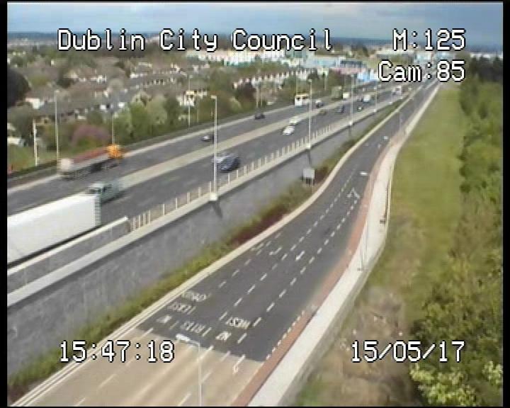
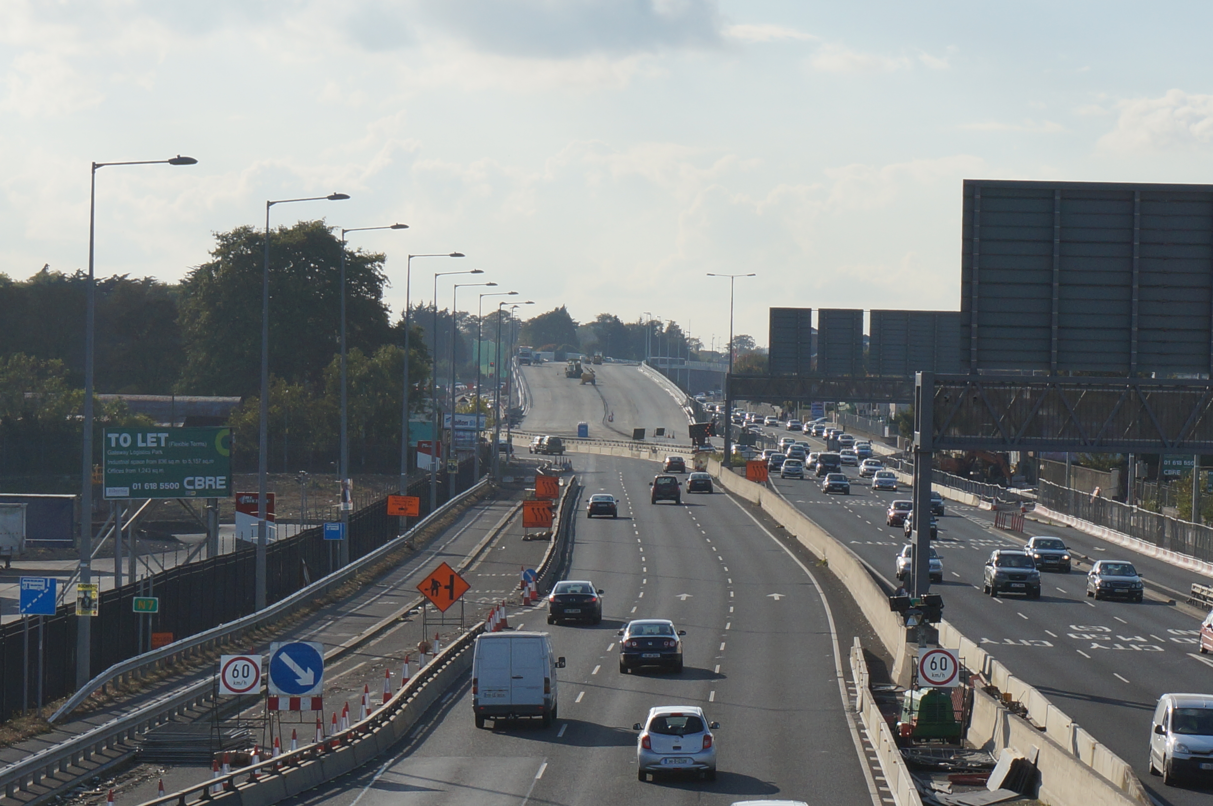
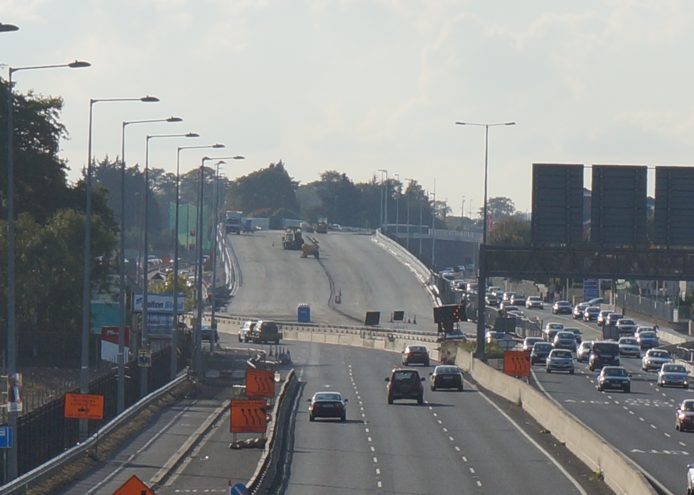
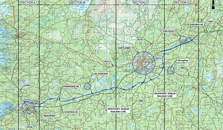