The N2 was a straight road winging its way out of Dublin in a north-northwesterly direction, striking out for Derry. Beyond about Slane, is reverts to a winding country road. Near Dublin, it passes the large satellite town of Ashbourne.
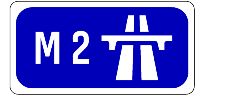
In May 2006, a 17km high quality dual carriageway replacement for this latter section opened. In August 2009, 13km of this was reclassified M2, creating a new motorway.
The rest of the road is single carriageway. There is a long-term plan to upgrade from Ardee to the border to dual carriageway or motorway in order to tie in with another proposed dual carriageway, the A5, in Northern Ireland, which together would create a new route between Dublin and Derry.
Update 05/06/2020:
It has been announced that the Slane Bypass will be built as single carriageway, and not dual as previously indicated.
The scheme now moves to design phase.
The preliminary cost is €38 million and will include traffic management measures within Slane.
The preferred route map is here.
Update 12/07/2019:
The Slane Bypass is at Route Selection with announcement of the preferred route overdue now.
Ashbourne-Kilmoon Cross, Clontibret-NI Border and Ardee-Castleblayney are still all at feasibility study.
Update 28/11/2020:
Ashbourne-Kilmoon Cross, Ardee-Castleblayney and Clontibret-NI Border dual carriageways are at route selection.
Update 25/02/2021:
The preferred routes for the two new N2 schemes have been published.
The one for the N2 - Clontibret-NI Border scheme is here and Ardee to Castleblayney is over here.
The northern scheme "cuts the corner" as it passes Monaghan and will shorten the distance a good bit (about 1.5 km) as well as allowing it to be taken at higher speed.
The southern scheme, on the other hand, follows the existing road very closely and will probably be built alongside it in the manner of the N4 Collooney-Castlebaldwin scheme which is currently under construction.
Update 07/03/2021:
There is another round of public consultation underway on the N2 Ashbourne-Kilmoon Cross scheme. An emerging preferred route has been picked. Planners went with E-2: this route runs immediately to the west of the N2 until the R155, then swings further west before coming back to hit Kilmoon Cross.
The Round 3 Consultation is available on the official scheme site. The emerging route can be found in it. The interfaces at either end haven't been nailed down yet and are still shown as large hatched areas.
For reference, here is the map showing all options from last summer.
Update 07/06/2021:
The Slane bypass is making progress.
It has been signalled that it is due for submission to An Bord Pleanala (Planning Board) by Q2 2022 - around a year away.
It aims to provide a short single carriageway bypass of this town which has an unusual layout and suffers greatly from traffic congestion, especially from trucks and lorries.
Update 04/10/2021:
For the Slane bypass here is the update from the TII: "A preferred route has been identified.
The detailed design and preparation of the statutory documents are underway.
Phase 3 - Design and Environmental Evaluation, expected to be complete in Q3 2021.
The preliminary business case is being progressed.
It is anticipated that this scheme will proceed to planning approval late 2021 or early 2022.
This scheme will be progressed with a public realm scheme."
Update 24/02/2022:
The Option Selection Report for the N2 Ashbourne-Kilmoon Cross scheme has been published. Here are some extracts.
On page 7-74 (PDF page 200), section "7.5.4.2 Analysis":
"A Type 1 Dual Carriageway cross-section has been proposed for all route options".
Separately it is confirmed that motorway would be "excessive" so the Type 1 road will not open as one.
According to the section "7.1.1.4 Preliminary Junction Strategy", there will be no intermediate junctions, the northern tie-in will be a roundabout, and the southern tie-in a grade separated junction.
Previously it was hoped that the Tayto Park amusement park would get its own junction as it is a large traffic generator especially in summer and is currently expanding.
This is a preliminary strategy however and so is subject to revision.
From the section "7.1.1.8 Route Option E-2" (the chosen option), here is a description of the proposed route:
"This option consists of a section of online widening of the existing N2 from the tie in with the M2
motorway at the southern junction corridor at Rath ... This option then diverges from the existing N2 and bypasses the
Primatestown junction in an offline section to the west of the existing N2. The offline section crosses
the R155 ... The offline section then ties in with the existing N2 and the R152 at the northern junction corridor at Kilmoon."
It isn't clear if the "online widening" of the existing N2 will result in the removal of a parallel single-carriageway road in order to cater for local traffic or if a new road will be provided for this purpose.
The latter option is the more likely as it is best practice.
Update 06/11/2022:
The preferred route for N2 Ardee-Castleblayney has been made available on a GIS site.
The scheme incorporates the 2005 Carrickmacross bypass, which will be dualled, and 6 new grade-separated junctions will be provided.
Two existing junctions at Carrickmacross will be modified and expanded.
Update 11/12/2023:
The planning application for the N2 Slane Bypass was submitted on the 6th of December.
The official press release is here. It will measure 3.5 km long and will be dual carriageway - previously it was to be built as single..
A previous application was rejected in 2012 as it impinged too much on the special conservation zone around Newgrange, called Brú na Bóinne.
A map of the scheme is on page 2 of this document.
There will also be a 1.3 km realignment of the east-west N51 road.
Update 07/01/2024:
There is good news on the N2 Clontibret to Border project, a dual carriageway that will run the east of Monaghan town to the Northern Ireland border, cutting the corner of the existing N2 to shorten the distance.
This scheme was suspended in 2021 by the Minister for Transport but in November of this year it was resumed:
After being suspended for almost two years, the N2 Clontibret to Border Road Scheme has secured EU and Department of Transport funding and is now back up and running.
Jacobs commenced the design process for this project in late 2018. The design process is following a framework set out by Transport Infrastructure Ireland (TII) called the 'Project Management Guidelines'. The guidelines break the design of major road projects into phases, and by early 2021 Phase 1 and 2 of the design process were complete, and a 400m wide Preferred Route Corridor was published.
...
The Phase 3 design process is recommencing in November 2023. Jacobs continue to be the engineering consultant, working on behalf of Monaghan County Council to design the road scheme. Due to the time that has lapsed since the project was suspended, Jacobs may need to review or repeat some previous work, for example environmental surveys may need to be updated. The project team will be in contact with landowners along the route to request access to lands for these surveys.
...
As the design of the road develops the project team will meet with directly affected landowners to discuss the potential impact of the scheme - this is expected to take place in late 2024/early 2025. Feedback will then be considered before a design is finalised. Compulsory Purchase Order (CPO) documentation and an Environmental Impact Assessment Report (EIAR) can then be completed - it is expected that this element of the project will be complete by Q4 2025. Subject to further funding, approval and Government consent, the project could then be submitted to An Bord Pleanála as part of the statutory approval process.
The press release explains that the scheme was reactivated after an alternative funding source was found from the Connecting Europe Facility, an EU fund that targets infrastructure investment that will promote growth, jobs and competitiveness.
The tender for the ground investigation works has indeed been published, so it looks like things are moving here finally.
Upgrading the N2 and the A5 on the Northern Ireland side are island-wide priorities which will create an improved Dublin-Derry and Letterkenny corridor, when combined with associated schemes such as N14 Letterkenny-Lifford which are making progress as part of separate initiatives.