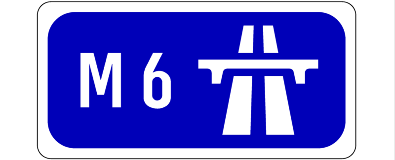
The road from Dublin to Galway is around 200 kilometres long and uses the M4 motorway for the first 60 km, and the M6 for the remainder. The M6 starts at the M4/M6 divide and heads west.
The old N6 used to pass through a series of Dublin commuter towns such as Rochfordbridge and Tyrellstown until a dual carriageway was opened in December 2006 as far as Tyrellstown, and Kilbeggan in May 2007. More dormitories were next such as the infamous Moate, before the road finally reached the large midlands town of Athlone. This section was replaced by a new dual carriageway in July 2008. In September 2008, the new dual carriageway sections were all designated M6 and were subjected to motorway conditions.
Athlone was bypassed with a cheap grade-separated dual carriageway way back in June 1991, replacing a detour through the town's winding streets. To ever make this a motorway, some work would need to be done to improve the short ramps, and possibly add weaving lanes. The bypass is riddled with 6 interchanges even though it's only 9 kilometres long. Sure enough, the bypass was left as a dual carriageway in the motorway redesignation round that was implemented in August 2009. There is no timeframe for an improvement, if indeed any will ever occur.
The old N6 gets progressively quieter as one continues further west. It winds it way down to the town of Ballinasloe, squeezing over a bridge and an S-bend, before starting its long lonely journey southwest to the distant town of Loughrea. From there, it covers around the same distance again before finally reaching the outskirts of Galway.
A long time ago, the N6 (or T4 as it was then known) took a more direct route from Ballinasloe to Galway, heading directly west via Athenry. This road is now only a minor regional called R348. Work on completing the new M6 alignment of the N6 was finally brought to a close on 13th December 2009. The Athlone-Ballinasloe section, including a bypass of Ballinasloe, had been first, in July 2009. The long Ballinasloe-Galway section followed a few months later, bringing the Dublin-Galway journey time (from outskirts to outskirts) down to below 2 hours. The new road does not parallel the old N6, but instead follows the even older Athenry route. It is also noteworthy that the last section, specifically the part from Galway to west of Ballinasloe, is tolled.
In the outskirts of Galway, the N6, both existing and future, ends in the townland of Rosscam. The existing route intersects the north-south N18 Galway-Limerick road at the town of Oranmore before using a new dual carriageway route built in the 1990s to enter the city from the north. The new route, not a motorway but a dual carriageway, will end at the townland of Doughiska but a bypass will skirt the city to the north further out, before finally coming to an end at the N59 northwest of the city. This represents a scaling back of the original route which would have terminated west of Barna on the coast a long way to the west of the city. However, the missing Doughiska-Barna piece is going to be built by Galway City Council as a regional project.
The bypass is controversial as it will likely sever the Gaeltacht suburb of Menlough and other areas from the rest of the city. This and other issues have delayed it by years and it was not listed as a part of the interurban motorway network - and therefore was not completed by 2010. Even the scaled back version of the bypass was only granted planning permission in December 2008. However, in April 2013, it was blocked by a European Court of Justice ruling.
As of early 2015, it was back in planning with a preferred route to be announced, when consultation was concluded. The new route would go as far as Barna west of the city, the part that was previously curtailed. This represented a reset to the original routing.
In 2022, permission for this iteration was quashed, and in 2023 it was re-submitted. The scheme seems to be stuck in a design and planning hell where it cannot avoid environmental litigation and is endlessly redesigned. There may be something to be said for building a cheaper single carriageway bypass much further out, and targeted grade separations of the existing bypass within the built up area.
You can continue to follow the glacial progress this scheme is making on the Updates section of the official website.
Update 07/05/2015:
Today, the emerging preferred route for the new Galway Bypass was announced. The PDF map is here. RTE have details surrounding the plans. I have updated this site's map of the route too. It seems that Galway City Council got their wish and the bypass is quite far from the city centre and the existing bypass. The existing bypass approaches within 800 metres of Eyre Square, the historic centre of Galway; the closest approach of the new bypass will be 2.8 km. The new road is mostly a dual carriageway except for the western end which will have sparser traffic and be single carriageway with roundabouts. In all, the new bypass consists of 10.9 km of dual carriageway and 5.5 km of single.
To the east, the road begins right at the existing terminus of the most recently built parts of the N6/M6 at Doughiska where there is a large roundabout joining the new roads to the current bypass. The roundabout will be replaced with a complex interchange providing access to four roads - the existing and new bypasses to the north, the existing R446 to the south, and the N6 heading east to the M6.
Perhaps oddly, the existing N6 to existing bypass will be the main flow here - traffic arriving from the east will have to turn off to enter the new bypass, and vice versa. This detail alone puts the final nail in the idea that the new bypass might be a motorway continuation of the M6 - if it was, traffic would probably have to pass through lights or roundabouts to continue to the new route. The large new junction features a lot of loops and turning slips which look rather small and tight.
There will be three major junctions - with the N59, the N84, and surprisingly, with the N17. Previously it was planned that the bypass would have no junction with the N17 Tuam Road, partly in order to force bypass traffic onto the M6 and the new M17 which is currently under construction instead. This in turn was because the village of Claregalway is badly in need of a bypass, but none is forthcoming. Surely the new junction with the Tuam Road will now mean that a Claregalway bypass will be essential, since no traffic in the city centre or west of Doughiska will use the M17 to get to Tuam.
In addition, the N17 Tuam Road junction will be a double-junction, also featuring slips to a new distributor road that will link the Parkmore and Ballybrit industrial estates.
Most controversially, the new bypass will feature two tunnels in order to avoid damaging an area of limestone pavement and the Galway Racecourse. However, since the surface cannot be disturbed, this will mean that both tunnels will have to be drilled - an expensive option compared to cutting and covering. These tunnels are both being done to placate opposition and don't make a lot of sense from a practical or cost perspective.
According to the RTE article, there will be around 45 houses under threat of demolition due to the plans. In particular, at the N59 crossover, most of the houses visible in this aerial view will need to be entirely demolished, including a group of new houses called Ard An Locha. This is unfortunate, and emphasises the importance of forward planning for route alignments for infrastructure. Otherwise, a swathe of destruction may need to be cut through an urban area. However, note that the detailed design of the route has not been decided, and the exact pieces of land and property that will be needed to build it are not yet set in stone.
The road between the N6 at Doughiska and the N59 is an 8 km dual carriageway, and probably a high-quality one. However, the dual standard only continues further west another 2.9 kilometres as far as Ballymoneen Road. From here, it narrows to a 5.5 km single carriageway road with roundabouts, but intersections with minor roads all seem to be bridged. In all, there will only be 4 roundabouts along this section, with presumably no access at all in between.
Finally, some guesses as to numbering. Since the existing bypass is only numbered N6 as far as the N59 junction, it's worth wondering if the new bypass will be the same, with the part from the N59 to Barna a regional road. I am assuming the dual carriageway's new junctions will be numbered 20-23, following the existing sequence.
The next steps will be to move to land purchase and design. The RTE article states that Galway City Council intend to submit planning documents early next year before moving to construction in 2017. If this was followed, the road would open by 2020. It does seem optimistic since as of 2015 there is no secure funding available in any case.
Update 19/05/2015:
A higher-detail map has been made available by Galway County Council.
Update 18/07/2017:
As a result of the ongoing design process, a new map featuring layout changes has been issued. The main change is to roll up the slips leading to the Parkmore Business Park. East and westbound access to the bypass from the local area is still available.
Update 02/11/2018:
The latest news on the design of this scheme is that it will be a motorway after all. The junction at Doughiska will flow the existing N6/M6 onto the bypass. The latest design document is here - Doughiska is on page 11.
Update 12/07/2019:
The scheme is still with An Bord Pleanala (Planning Board) and a decision is not expected until summer 2020.
East Athlone Motorway Services Area is due to open in November 2019.
Update 12/09/2019:
East Athlone Motorway Services Area has opened to the public after several years in legal limbo due to a court challenge.
Update 07/02/2021:
A decision on planning permission for the M6 Galway Bypass is due in late April.
Update 08/12/2021:
The Galway Ring Road has been approved by An Bord Pleanala, the planning authority, as reported on RTE:
"An Bord Pleanála has approved a multi-million euro road project, aimed at alleviating traffic congestion in Galway City.
The N6 Galway City Ring Road would comprise dual and single lane carriageways, over an 18 kilometre route.
....
A formal application for the ring road was submitted over three years ago. Since then, Compulsory Acquisition Notices have been issued to around 500 landowners along the favoured route.
The lead agency for the project, Galway County Council, estimates the road would take three years to construct. It would involve a number of tunnels, as well as a viaduct over the river Corrib.
The N6 Ring Road plan follows a failed attempt to construct a by-pass of Galway city more than a decade ago. The proposed road would cost at least €600 million."
It is not yet confirmed if the road will open as a motorway, or a motorway-standard dual carriageway.
Update 18/02/2022:
The much-beleaguered M6 Galway Bypass (Galway Transport Project) has had three Judicial Reviews lodged against its planning permission.
The first is by Friends of the Irish Environment (FoIE), the second by Brooks Timber & Building Supplies and the third is by Galway Race Committee.
The latter is surprising, as they already were the cause of huge extra cost being added to the project when they insisted on the road being tunnelled under their racecourse instead of passing a ground level.
This was agreed to, and their new complaint is that their stables will be affected.
The scheme continues to be controversial, with many people strongly against, but many others strongly in favour.
The CEO of Galway Chamber, Kenny Deery, has said that the opponents of the Galway City Ring Road are "not connected with reality".
In the audio clip included with that article, he points out that BusConnects (a project to improve bus facilities in the city), numerous cycling projects and rail upgrades are also planned for the city.
The Minister for Enterprise, Leo Varadkar, who is also the Tánaiste (junior prime minister), has publicly endorsed the road, directly opposing a request from FoIE asking for his support in their legal challenge.
From the article:
"The organisation [FoIE] said that even if the parties did not support its position on the project, Government parties should support the right of environmentalists to access the courts."
Watch this space.
Update 14/10/2022:
Planning permission for the highly controversial M6 Galway Bypass has been quashed (annulled), as reported in the media.
The case was taken by Friends of the Irish Environment and An Bord Pleanala (Irish Planning Board) conceded that they had granted permission without taking into account the government's latest Climate Action Plan, which had been published a mere 4 days previously.
The Board will now re-examine the planning application in the light of the Climate Plan.
There is no certainty the road will ever be built as inflation in the construction sector is so high and there is no doubt this road will facilitate car use in the city of Galway, which is against national policy.
Separately there is a Bus Connects plan for Galway which will see the reorganisation of the city's bus system and the provision of bus and cycle lanes.
Update 24/09/2023:
Recently the Department of Public Expenditure announced a progress update on major infrastructure projects.
The N6/M6 Galway Bypass is a surprising inclusion as it is now unlikely that the scheme will proceed in its current form on environmental grounds.
It is listed as aiming for main contractor procurement by Q1 2025.
First it would need a valid planning permission!
Update 03/11/2023:
Planning for the 18 km Galway Ring Road has been resubmitted. Previously this was granted permission, but the permission was quashed because the planning board did not take into account the government's Climate Action Plan.
The article does not go into detail (as it may not be available) as to what changes have been made to the application. It will need to address the issues that caused the quashing the first time around.
Update 11/12/2023:
The Taoiseach Leo Varadkar commented today that he is certain that the Galway Bypass is compatible with the government's climate goals.
"The Taoiseach has said that he does not believe that the construction of a ring road around Galway is in conflict with the Government's climate action targets, but said he would be afraid to put a timeframe on the project given the delays it has faced.
Speaking at the opening of the N59 Maigh Cuilinn Bypass in Galway, Leo Varadkar said he was hopeful that planning permission would be granted for the project next year.
He said while there is a possibility of legal challenges after that, the new Planning and Environment Division of the High Court, which sits for the first time today, will enable these kinds of cases to be heard more quickly."
Update 27/02/2024:
The Galway Bypass is stuck in bureaucratic hell, with more documentation, including an updated traffic model, due to be submitted by Sep 2024.
Update 10/04/2026:
The long-awaited Galway Ring Road has finally been approved after more than two decades of delays, marking a significant milestone for one of Ireland's most contentious infrastructure projects.
The route is a total of 18km long, with a mix of motorway and single carriageway. It will run from the M6 east of the city to a point west of the Connemara village of Bearna.
The budget has been set at €1 billion under the National Development Plan.
The project is aimed at tackling chronic traffic congestion in the city, but it comes after years of planning hurdles, objections, and legal challenges that repeatedly stalled progress.
Homeowners along the route have been waiting 20 years for a go no-go decision.
There have been false dawns before. Most recently planning was granted in 2021, but this was later quashed after courts ruled the permission had failed to take the Government's Climate Action Plan into account.
The bypass on its own of course will not solve the city's transportation problems. Karen Ronan of Galway Chamber said the road was a key part of a broader transport strategy.
She pointed to the need for "complementary measures including BusConnects, expanded rail services and greater investment in cycling infrastructure."
It remains to be seen if the existing bypass will have space reallocated in favour of sustainable transport modes after the new bypass is completed.
All going well, construction could start in 2028.
While supporters see the road project as essential for economic development and connectivity, the drawn-out process highlights just how difficult it has become to deliver major infrastructure in Ireland, particularly where environmental concerns and planning disputes collide. In response, new legislation due to be enacted by July signals a decisive shift in how the State handles such projects. Although it will come too late to affect the Galway decision, which may still be subject to judicial review, the law will prevent legal challenges to critical infrastructure on climate grounds, effectively curbing what the Government views as excessive or sometimes spurious litigation by environmental groups.
The aim is to accelerate delivery of key projects in transport, energy, and housing, reducing delays that have become almost routine, although critics argue this could come at the cost of environmental accountability.
The Green Party has described it as the "death of the Climate Action Act", and stated that "The Government is in essence repealing the Climate Action Act by the back door."
The legislation will also reduce the number of steps that projects are required to pass in order to move to construction, if the project is deemed critical infrastructure.
Ireland currently has a large backlog of water, transport and energy projects which are urgently needed.