National Primary Route 8 Traffic Counts (Old Route)
Sources: TII Traffic Data and now-defunct NRA Traffic Count Data. More counters.
1997
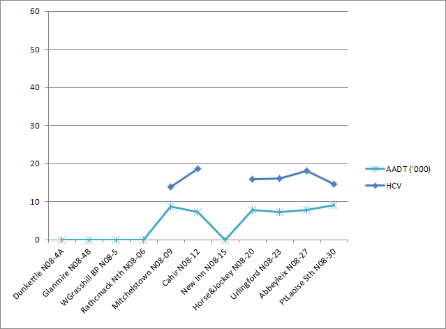
The old N8 reached traffic levels of around 10-15k before it was comprehensively replaced by the M8. The Dunkettle and Glanmire counters date from the early 90s while Watergrasshill is from 2003. The rest of the counters date from 2007-2010.
Note that this graph is longer being maintained, since most of the points are bypassed. See the M8 Counts page for current information.
Show notes on counter locations
Dunkettle N08-4A : N8 south of N25/N8 interchange
Glanmire N08-4B : N8 at Glanmire/Glasaboy overpass
WGrasshill BP N08-5 : N8 on Watergrasshill bypass
Rathcmack Nth N08-06 : N8 immediately north of Rathcormack
Mitchelstown N08-09 : N8 5km south of Mitchelstown at Kilworth Camp
Cahir N08-12 : N8 10km south-west of N8/N24 roundabout
New Inn N08-15 : N8 2km south of New Inn
Horse&Jockey N08-20 : N8 2km south of Horse & Jockey
Urlingford N08-23 : N8 3km south of Urlingford
Abbeyleix N08-27 : N8 3km south of Abbeyleix
PtLaoise Sth N08-30 : N8 immediately south of M7/N8 interchange