National Primary Route 20 Traffic Counts
Sources: TII Traffic Data and now-defunct NRA Traffic Count Data. More counters.
1998
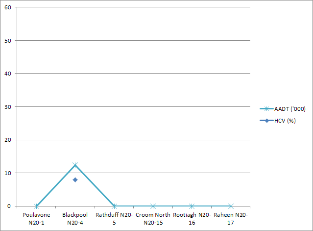
All traffic counters for the N20 lie within the Limerick and Cork metropolitan regions, with the exception of Rathduff. The Rootiagh and Raheen counters lie on what is now the M20, redesignated in 2009, and are showing high levels of Limerick commuter traffic. The Croom counter, lying after the N20/N21 split, shows a far lower level due to the division of traffic streams.
Down south in Cork, Blackpool shows a high count and marks the end of the current dual carriageway section. The need for an extension northwards is certainly apparent judging from the high count at this point, which peaked at 24,000 in 2007. Even Rathduff, 18 km out, was up to 18,000.
Show notes on counter locations
Poulavone N20-1 : N20 south of roundabout on eastern side of Ballincollig (note: possibly erroneous, seems to be on N22 not N20)
Blackpool N20-4 : N20 2km south of junction to Blarney
Rathduff N20-5 : N20 3km north of Rathduff
Croom North N20-15 : N20 2km south of N20/N21 interchange
Rootiagh N20-16 : N20 south of Loughmore interchange
Raheen N20-17 : N20 north of Loughmore interchange