|
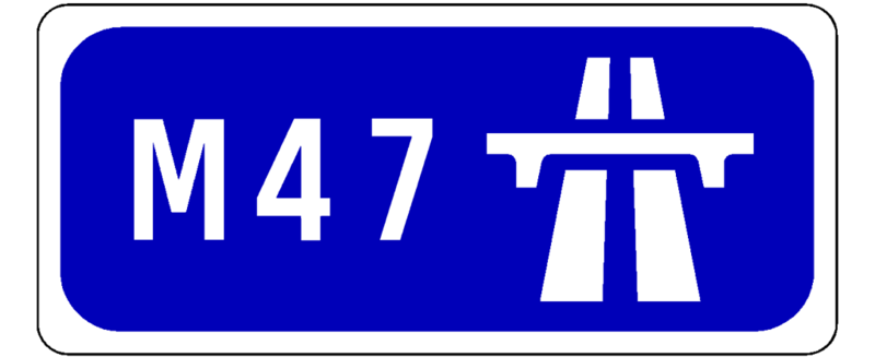
M47 Leinster Outer Orbital-M50 |
Could open : Never | Status : No longer needed | ||
|
|
|||
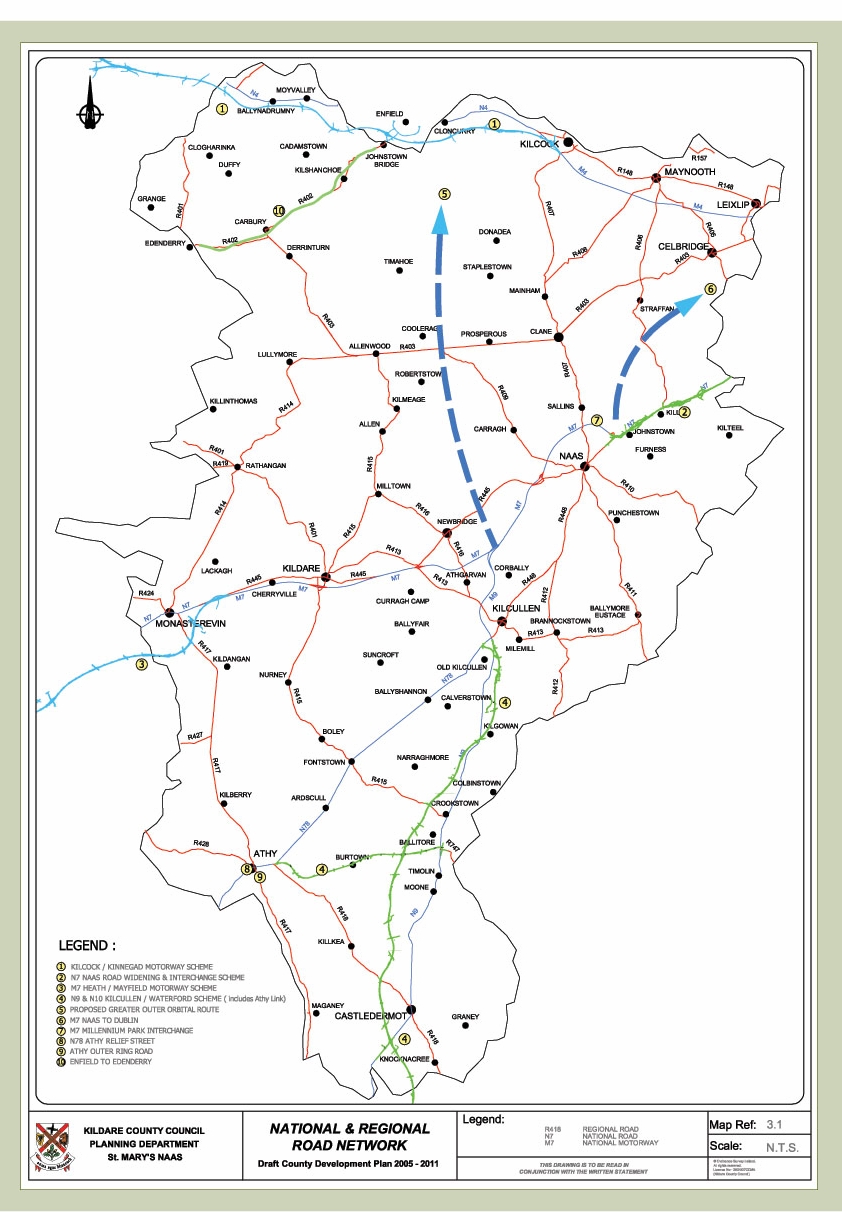
The original plan for the M50 C-ring motorway to the west of Dublin included a new-build motorway called the M7 which would have replaced the existing N7. This new motorway would have connected with the M50 between the existing N4 and N7 junctions. Since these are 7 and 9 respectively, the new junction's number would be 8. The M50 is long since completed now and still there is a gap between junctions 7 and 9. The M7 now appears to be dropped, though it still appeared on development plans until relatively recently, as this example from 2004 shows. Surrounding roads have seen big upgrades, too. The N4 has been 6-laned between the M50 and the start of the M4. The N7 has also seen 6-laning and a large number of grade-separated junctions completed between the M50 and the start of the M7. The Outer Ring Road north-south dual carriageway connects the N4 with the N7 and beyond. There has been extensive suburbanisation of the corridor the proposed M7 would have run through and remaining undeveloped land is earmarked for future communities. Pertinent also is the proposed Leinster Outer Orbital, referred to on this site as the M45, which will ring the city further west. That said, the case for a new radial along the M7 route remains. The northwest of the city has 3 radial motorways or dual carriageways; the M1, the N2/M2, and the N3/M3. The M4 runs precisely west. However, the southwest of the city, despite leading to the nation's 2nd, 3rd, and 5th biggest cities (Cork, Limerick and Waterford respectively), has only the N7/M7 and the short N81 dual to show for itself. At least one more radial will be needed in the long term if the N7 and N81 are not to become completely saturated with traffic. The M47 is a proposed motorway which would complement the N7 rather than replacing it. Starting at the missing Junction 8 site at the M50 and heading southwest, it would terminate at the M45, from where motorists could continue either north to join the M4 or south to join the M7 and M9 motorways. Traffic headed in the other direction (Dublin-bound) and approaching from the M4 or M7 could use the M45 to access the M47 and continue all the way to the M50 without having to negotiate the very busy M50 approaches on the N4 and N7 at Liffey Valley and Red Cow respectively. The road would be 6-laned in order to adequately serve an alternative for both the 6-lane N4 and the 6-lane N7 roads. It is numbered 47 as it is between the N4 and N7 routes and 47 is an unused number. There are considerable obstacles to this project. The assumption that the project is cancelled has resulted in its land space near the M50 being reallocated to urbanisation plans. These are centered around creating new communities flanked by the railway line to the north and the Grand Canal to the south. The only clear run for the road would be through this zone, which would place high-density neighbourhoods immediately next to a 6-lane motorway. In addition, it is unclear if the resulting routing would be ideal from the point of view of distance. In particular for M7/M9 traffic, motorists approaching Dublin would have to drive two sides of a triangle (north up the Leinster Outer Orbital, east along the M47) instead of the more direct N7 routing. The road would not then reduce traffic on the N7 in particular by enough to make it worthwhile as a decongestion measure. The likelihood of this project coming to fruition is therefore low. The only way to circumvent these problems would be to terminate the scheme at the Outer Ring Road here and omit the final leg to the M50. This would necessitate making the route a dual carriageway only as it would no longer be capable of handling motorway levels of traffic. A better place to terminate that completely avoids land earmarked for the future is on the new T-junction on this map. This would make the route a long extension of Nangor Road which passes through the industrial and residential areas of Clondalkin. This re-speccing of the road would make it a 21 km dual carriageway instead of a 29 km motorway. Update October 2015: There are now plans to upgrade to motorway the whole of the N7 Naas Dual Carriageway from the M50 to Naas (source). Therefore, this scheme is no longer needed and the map has been removed.
Widget is loading comments...
| ||||
Wikipedia page on this road (none - new route) |
||||
ESSENTIAL INFO :
| Origin | M50, midway between Jct 7 and 9 |
| Terminates | M45, midway between M4 and M7 |
| Places Served | Clane, Celbridge, Lucan |
| Routes Spawned | - |
| Intersects | M45, M50 |